
This section presents several project summaries where mining waste reuse has been considered, and in some cases, successfully implemented. Table 6-1 lists the project summaries and the eight sites that have full case studies.
Table 6-1. List of mining sites with project summaries
| State | Site Name | Mine Status | Target Application | Mining Waste | Mineral of Interest |
| AZ | Eagle Picher Mill Voluntary Remediation Program Site – Brief – Full Case Study |
Closed | Remediation, land reuse | Tailings | Not applicable |
| CA | Empire Mine State Historical Park – Brief |
Closed | Land reuse, metal recovery, road construction reuse, and potential remediation reuse | Tailings and waste rock | Gold and silver |
| CO | Bonita Peak Superfund Site, Kittimac Tailings – Brief – Full Case Study |
Abandoned | Remediation, reclamation, two waste streams commingled for inert monofill | Water treatment sludge, tailings | Not applicable |
| CO | Captain Jack Mill Superfund Site – Brief |
Abandoned | Remediation, use of neutralizing waste rock to stabilize/cap acid-generating waste rock | Waste rock | Not applicable |
| CO | Central City/Clear Creek Superfund Site – Brief |
Abandoned | Metal recovery from water treatment sludge | AMD treatment sludge | REEs |
| CO | Denver Radium and Ultra Mill Tailings Remedial Action Sites – Brief |
Abandoned | Land use management of legacy mining waste in the environment | Tailings | Not applicable |
| ID | Stibnite Mining District – Brief |
Abandoned | Metal recovery from historical tailings | Tailings | Gold, antimony |
| MI | Copper Mine Tailings on the Keweenaw Peninsula, Torch Lake Superfund Site – Brief – Full Case Study |
Abandoned | Construction uses | Tailings | Not applicable |
| MO | Madison Mines Superfund Site – Brief – Full Case Study |
Active permit to reopen | Metal recovery from historical tailings | Tailings | Nickel, cobalt, copper |
| MT | Anaconda Smelter Superfund Site – Brief – Full Case Study |
Closed | Remediation, land reuse | Slag | Not applicable |
| MT | East Helena Superfund Site – Brief |
Closed | Metal recovery from slag | Slag | Zinc |
| MT | Golden Sunlight Mine – Brief |
Closed | Metal recovery from tailings | Tailings | Gold, sulfur, REEs |
| MT | Silver Bow Creek/Butte Area Superfund Site – Brief – Full Case Study |
Closed/ active | Remediation and economic value | AMD and AMD treatment sludge | Copper, zinc, manganese, magnesium, REEs |
| NM | Carlsbad Potash and Salt Mining – Brief |
Active | Mine process wastewater evaporation for salt products | Wastewater | Salt |
| NM | Chevron Questa Mine Superfund Site – Brief |
Closed | Remediation, land reuse | Tailings | Molybdenum |
| OK | Tar Creek Superfund Site – Brief – Full Case Study |
Abandoned | Remediation, construction uses, critical minerals | Chat | Zinc, germanium |
| SC | Brewer Gold Superfund Site – Brief – Full Case Study |
Abandoned | Remediation through reprocessing mining waste for economic value | Waste Rock | Copper, gold |
| WA | Midnite Mine Superfund Site – Brief |
Closed | AMD treatment sludge, uranium extraction, on-site remediation for waste containment | Sludge, waste rock | Uranium |
6.1 Project Summaries
6.1.1 Arizona
6.1.1.1 Eagle Picher Mill Voluntary Remediation Program Site
The Eagle Picher Mill site was used for lead-zinc ore milling from 1943 to 1959. Mill waste was placed in a 35-acre tailing impoundment. In the late 1960s, the buildings were demolished, and the tailings impoundment was capped with a vegetated soil cover. The site entered the Arizona DEQ Voluntary Remediation Program in September 2016 to address residual impacts from these historic mining operations that posed a risk to human health and the environment ( Arcadis U.S., Inc. 2022 [NKHV7C57] Arcadis U.S., Inc. 2022. “Probabilistic Risk Assessment, Former Eagle Picher Mill Site on Parcel 30, Sahuarita, Arizona, VRP 512782. July.” ). The Volunteers, Amax Arizona Inc. (Amax), and Anaconda Arizona Inc., conducted a human health risk assessment (HHRA) for recreational use, excavated contaminated soils and placed them on the existing tailings pile, and constructed an engineered cap over the tailings, which was topped with 2 feet of clean soil. A land-use restriction was put in place to restrict the site to nonresidential uses and provide for long-term maintenance of the engineered cap. The Volunteers developed an open space landscape design to transform the site into a public park, including walking trails, shade structures, and pollinator gardens (also see Section 6.2.1).
6.1.2 California
6.1.2.1 Empire Mine State Historic Park
The Empire Mine site is an old, abandoned gold mine in the foothills of the Sierra Nevada range that operated from the 1850s through 1955 and recovered about 5.8 million ounces of gold. The land was purchased in 1975 by the California Department of Parks and Recreation (State Parks) from Newmont Exploration Limited, which retained some subsurface mineral rights ( California DTSC and California CVRWQCB 2006 [4SES8VC8] California DTSC, and California CVRWQCB. 2006. “Cleanup and Abatement Order. Imminent and/or Substantial Endangerment Determination and Consent Order. Empire Mine State Historic Park.” State of California. https://www.envirostor.dtsc.ca.gov/getfile?filename=/public%2Fdeliverable_documents%2F3156308829%2FEmpire%20Consent%20Order%20Final%2011.28.06.pdf. ). The site is now operated and managed by State Parks as a museum of historical mining with the mine and mill buildings preserved for tourism, along with areas for picnicking and trails for hiking, biking, jogging, and horseback riding ( California DTSC and California CVRWQCB 2006 [4SES8VC8] California DTSC, and California CVRWQCB. 2006. “Cleanup and Abatement Order. Imminent and/or Substantial Endangerment Determination and Consent Order. Empire Mine State Historic Park.” State of California. https://www.envirostor.dtsc.ca.gov/getfile?filename=/public%2Fdeliverable_documents%2F3156308829%2FEmpire%20Consent%20Order%20Final%2011.28.06.pdf. ; ITRC 2017 [KUYLBUKT] ITRC. 2017. “Bioavailability of Contaminants in Soil (BCS-1).” Interstate Technology and Regulatory Council. https://bcs-1.itrcweb.org/. ). It covers 852 acres in Nevada County near the City of Grass Valley, which is about 50 miles northeast of Sacramento, California. The gold mining process involved underground hard-rock stope mining with ore brought to the surface at the head works. The ore was then size reduced in a crusher and stamp mill prior to gold extraction via mercury amalgamation (until the 1920s) followed by flotation and cyanide leaching at the on-site cyanide plant. The mine has an estimated 367 miles of shafts and tunnels, most of which are abandoned and flooded, and the milling produced waste rock piles and tailings with mercury, cyanide, and arsenic concentrations above water quality standards and recreational risk-based levels in some places. The California Department of Toxic Substances Control, along with the Central Valley Regional Water Quality Control Board, began evaluating the environmental impacts with characterization beginning around the late 1970s and early 1980s and continues to implement various remedial measures ( California DTSC 1993 [2GLW327T] California DTSC. 1993. “Preliminary Endangerment Assessment Report. Empire Mine Site Historic Park.” California Department of Toxic Substances Control. https://www.envirostor.dtsc.ca.gov/public/final_documents2?global_id=29100003&doc_id=5007786. ). These measures consist of removal and remedial actions of areas with contaminated soils and sediments exceeding risk-based criteria (e.g., excavation with off-site disposal or capping with clean soil or gravel and closing certain trails to eliminate potential exposures).
The main current reuse application is as a historical park and mining museum. As early as 1947, the mined waste rock and mill sands were reused in construction of California State Route 49 of the Mother Lode Highway; this resulted in construction cost savings ( Lathrop 1949 [IM9PLEPJ] Lathrop, Scott H. 1949. “Foothill Road. New Highway between Grass Valley and Auburn Built.” California Highways and Public Works 28 (5–6): 50. https://archive.org/details/californiahighwa194849calirich/page/n473/mode/2up?view=theater&q=lathrop. ). Also, waste rock and other mining wastes that meet certain requirements may potentially be used on-site as part of a remedial action, if approved. One of the main sources of contamination at the site was the cyanided sulfide tailings area from which arsenic was leaching into nearby streams and affecting fish and wildlife. In 1982, the U.S. Bureau of Mines Reno Research Center and California State Parks entered into a Memorandum of Agreement to assess the economic potential of the cyanided sulfide tailings and to determine an appropriate method for containing the arsenic effluent and/or for disposing of the tailings ( Walters et al. 1985 [MLWY4FII] Walters, L. A., M. E. Piros, and N. S. Mallory. 1985. “Cyanided Sulfide Tailings at Empire Mine State Historic Park, Grass Valley California.” CA Department of Parks and Recreation and U. S. Bureau of Mines — Reno Research Center. ). They found that the tailings pile covered about 5 acres of land and contained 43,000 tons of material composed of minus 200 mesh pyrite with minor chalcopyrite, arsenopyrite, and galena and averaged 0.25 ounces of gold per ton. At the time, the estimated economic value was between $2.5 million and $3.9 million (at $400/ounce), depending on the recovery process. The recommended means of controlling the arsenic pollution was excavation and reprocessing of the entire tailings pile ( Walters et al. 1985 [MLWY4FII] Walters, L. A., M. E. Piros, and N. S. Mallory. 1985. “Cyanided Sulfide Tailings at Empire Mine State Historic Park, Grass Valley California.” CA Department of Parks and Recreation and U. S. Bureau of Mines — Reno Research Center. ). Later, in 1985, the Empire Mine Park Association and State Parks sold and removed the majority of the cyanided sulfide tailings pile to the Homestake McLaughlin Mine for use of the sulfides in their process and recovery of the gold contained in the tailings. After removal of the tailings in 1986, sampling of surface water associated with Little Wolf Creek showed improved water quality ( California DTSC 1993 [2GLW327T] California DTSC. 1993. “Preliminary Endangerment Assessment Report. Empire Mine Site Historic Park.” California Department of Toxic Substances Control. https://www.envirostor.dtsc.ca.gov/public/final_documents2?global_id=29100003&doc_id=5007786. ).
6.1.3 Colorado
6.1.3.1 Bonita Peak Mining District Superfund Site
The Bonita Peak Mining District site consists of 48 historic mines or mining-related sources where ongoing releases of metal-laden water and sediments are occurring within the Mineral Creek, Cement Creek and Upper Animas River drainages in San Juan County, Colorado. Historic mining operations have contaminated soil, groundwater, and surface water with multiple metals. USEPA and the Colorado Department of Public Health and Environment (CDPHE) have overseen investigation and reclamation of the Bonita Peak Mining District site since the early 1990s. The site was added to the National Priorities List (NPL) in 2016 ( USEPA 2024 [FK335CHF] USEPA. 2024. “Bonita Peak Mining District Site Profile.” U.S. Environmental Protection Agency. https://cumulis.epa.gov/supercpad/SiteProfiles/index.cfm?fuseaction=second.Cleanup&id=0802497#bkground. ).
Since 2018, innovative methods to reduce mobilization of metals from legacy mining tailings have been used in the district. One innovative use is the reuse of sludge waste from the Gladstone Interim Water Treatment Plant (IWTP), where MIW from the Gold King Mine is treated. At this location, 14,000 cubic yards of sludge from the IWTP were mixed with 20,000 cubic yards of tailings at the Kittimac tailings area. The sludge is intended to immobilize metals found in the tailings, thereby reducing human health and environmental impacts. A berm was created with the sludge/tailings mixture to prevent trespass activities at the location. Groundwater monitoring is conducted to ensure there are no negative impacts from the interim sludge management location ( USEPA 2024 [FK335CHF] USEPA. 2024. “Bonita Peak Mining District Site Profile.” U.S. Environmental Protection Agency. https://cumulis.epa.gov/supercpad/SiteProfiles/index.cfm?fuseaction=second.Cleanup&id=0802497#bkground. ). See Section 6.2.2 for more information.
6.1.3.2 Captain Jack Mill Superfund Site
At the Captain Jack Mill Superfund Site in Boulder County, Colorado, a stabilization/neutralization treatment was used where high NP waste material was used to cap a highly AP waste ( Anton et al. 2014 [R298R43U] Anton, Nick, Todd Bragdon, Mary Boardman, Joy Jenkins, and Chad Drie. 2014. “Surface Reclamation of the Captain Jack Mill Superfund Site.” Proceedings of the 18th International Conference on Tailings and Mine Waste (Keystone, CO). ). Several individual underground mines were present at the Captain Jack site. Most of the mines contained highly pyritic deposits and resulted in high acid-generating surficial waste rock piles. Surficial waste material at one of the mines contained significant lead concentrations from galena but also had high NP from excess calcite in the deposit. The Captain Jack repository was designed to have a vegetated soil exposure barrier that would not intentionally limit infiltration into the underlying waste material. Since some infiltration and contact with high AP material was anticipated over time, once consolidated, the surface of the high AP material was blended with lime and capped with a 2-foot-thick minimum layer of the high NP-galena material. The final 2-foot-thick soil barrier cover was then placed over the high NP waste material. Together, the lime amendment and the high NP waste material were intended to react with water that may infiltrate through the soil exposure barrier cover by dissolving excess alkalinity. Should water reach the high AP material, the excess alkalinity in the infiltrating water will help to reduce the amount of AMD that may be generated. No AMD has been observed, and the cap continues to maintain a healthy stand of vegetation.
6.1.3.3 Central City – Clear Creek Superfund Site
The 400-square-mile Central City–Clear Creek Superfund Site includes several former mining towns in Colorado. For almost a century, vast deposits of gold and silver ores in the area supported a profitable mining industry. The mining industry also left behind waste rock and mine tailings that contaminated the Clear Creek watershed. USEPA added the site to the NPL in 1983. After Colorado amended its laws to allow gaming in the former mining towns, parties worked with casino developers to clean up areas in two towns to support casinos, hotels, and restaurants. As parties developed the former mining property, they led cleanup actions. The historic Argo gold mill hosts tours and serves as a tourism attraction. The mill’s owners are exploring redevelopment opportunities ( USEPA 2016 [2GU7E6ZM] USEPA. 2016. “Superfund Sites in Reuse in Colorado.” Superfund Sites in Reuse in Colorado. https://www.epa.gov/superfund-redevelopment/superfund-sites-reuse-colorado. ). Critical mineral recovery from AMD sludge research is being done on this site ( Goodman et al. 2023 [P2TGVUX5] Goodman, Aaron J., Anthony J. Bednar, and James F. Ranville. 2023. “Rare Earth Element Recovery in Hard-Rock Acid Mine Drainage and Mine Waste: A Case Study in Idaho Springs, Colorado.” Applied Geochemistry, ahead of print. https://doi.org/10.1016/j.apgeochem.2023.105584. ).
6.1.3.4 Denver Radium Site and Uranium Mill Tailings Remedial Action Sites
The radium processing industry flourished in Denver, Colorado, between 1915 and 1927. Radium was first discovered in the late 1800s. It was valued for medicinal and industrial purposes such as cancer treatment, medical equipment, luminous paints, and other industrial purposes. In 1913, the U.S. Bureau of Mines entered into a cooperative agreement with a private corporation to establish the National Radium Institute, which successfully developed and operated a radium processing plant in Denver. The Colorado Plateau contained rich deposits of the radium-bearing ore, carnotite. Because of the presence of carnotite, numerous radium, vanadium, and uranium processing operations opened in Denver. The National Radium Institute used a nitric acid leaching process on carnotite ore to produce radium chloride, iron vanadate, and sodium uranate. Incidental products were sodium nitrate, barium chloride, and iron-calcium precipitate. The process was thought to recover more than 90% of radium, 85% of uranium, and about 30% of vanadium. Although much of the radium, uranium, and vanadium were recovered from ore, process residues containing uranium, radium, thorium, and other radioactive materials were discarded or left on-site when the processing facilities closed ( Colorado Department Environmental Health 2014 [L97HYKFB] Colorado Department Environmental Health. 2014. “Denver Radium Superfund Site Comprehensive Report.” City and County of Denver. https://www.denvergov.org/content/dam/denvergov/Portals/771/documents/EQ/CompleteRadiumReport2014.pdf. ).
In 1978, the U.S. Congress passed the Uranium Mill Tailings Radiation Control Act. This act tasked USDOE with stabilizing, disposing, and controlling uranium mill tailings and other contaminated material at 24 inactive uranium processing sites located in 10 different states where uranium was processed for sale to a federal agency. Nine of those sites are in Colorado. Although the active cleanup required by the act has been completed, residual uranium mill tailings remain in some communities. The CDPHE is authorized by Colorado Revised Statutes 25-11-301 et. seq. to assist local governments in identifying and managing the uranium mill tailings that remain in western Colorado communities. The CDPHE developed a Uranium Tailings Management Plan ( CDPHE 2019 [42SN9RHW] CDPHE. 2019. “Uranium Mill Tailings Management Plan.” Colorado Department of Public Health and Environment. https://cdphe.colorado.gov/hm/umts. ) to assist utilities and private parties in the identification, proper handling, and disposal of uranium mill tailings because tailings deposits are often associated with utility rights-of-ways and private property. At the Denver Radium Superfund Site and at Uranium Mill Tailings Remedial Action sites regulated by the USDOE, some of these radioactive waste residues were used as part of street and roadway construction, fill material, or aggregate in asphalt paving surfaces, and as a free and readily available source of material for backfilling around residential structures. At the Denver Radium Superfund Site, several Denver street segments contain contaminated aggregate in asphalt. These street segments contained a 4- to 6-inch layer of radium-contaminated asphalt underlain by compacted gravel road base. Usually, these street segments were overlain by 4- to 12-inches of uncontaminated asphalt pavement. The uncontaminated asphalt did not provide sufficient shielding, and it was determined that the radium-contaminated asphalt posted a sufficient health risk to warrant taking action to protect human health. It is estimated that 38,700 cubic yards of radium- contaminated material was removed and disposed of at Denver Radium OU7 (Denver Streets).
6.1.4 Idaho
6.1.4.1 Stibnite Mining District
The Stibnite Gold Project is in Valley County, Idaho. The proposed project includes a comprehensive restoration, operation, and reclamation plan that will guide the cleanup and reprocessing of old tailings at a legacy mining site. Site reclamation is expected to reestablish habitat and water quality for an important salmon fishery that has been heavily impacted from legacy mining in the area ( USFS 2022 [HJAFYFIZ] USFS. 2022. “Stibnite Gold Project. Supplemental Draft Environmental Impact Statement (SDEIS). Public Meeting Materials.” https://storymaps.arcgis.com/stories/6b13451c9abb4f8090fabc579f982aec. ). The project should concurrently improve the local economy of Valley County and of Idaho. The proposed Stibnite Gold Project is designed to reestablish a U.S.-based source of the critical mineral antimony as a by-product of one of the highest-grade open-pit gold resources in the country. Antimony trisulfide is essential to national defense as a key component for munitions, yet no domestic mined supply currently exists. The mine was conditionally awarded up to $34.6 million in additional funding from the DOD under the existing Technology Investment Agreement through Title III of the Defense Production Act, bringing its total funding under the act to $59.4 million ( Perpetua Resources 2024 [VSZFT9QX] Perpetua Resources. 2024. “Perpetua Resources Receives up to an Additional $34.6 Million Under the Defense Production Act.” Perpetua Resources | Corporate. https://www.investors.perpetuaresources.com/investors/news/perpetua-resources-receives-up-to-an-additional-34-million-under-the-defense-production-act. )
6.1.5 Michigan
6.1.5.1 Torch Lake Superfund Site
The Torch Lake Superfund Site was one of the largest copper mining regions in North America in the first half of the 1900s. Copper was extracted from the ore with stamp mills to liberate the copper metal from the host rock. Approximately 500 million tons of host rock tailings (called stamp sand) were dumped in the interior waterways of the Keweenaw Peninsula and along the shorelines of Lake Superior. The erosion of metal-containing stamp sand severely threatens the aquatic organisms living on the lake bottom and their habitats with its physical migration. The uncovered stamp sand piles are still being eroded into the water or drifting along the lakeshore. These tailings are basaltic, ready crushed, and relatively uniform. These tailings have been used as a raw material for concrete blocks, road construction, and traction on icy road surfaces. Research also demonstrated they can be used as antimicrobial roof shingle granules, sandblast sand, and aggregate in asphalt pavement (Section 6.2.3).
6.1.6 Missouri
6.1.6.1 Madison County Mines Superfund Site
An interested party purchased a closed metals mine (that was going through CERCLA to address erosional impacts from legacy mine tailings). The new property owner worked with USEPA and Missouri DNR to develop a plan to reprocess and close the mine tailings and eventually reopen the mine for critical minerals (mainly cobalt and nickel). The reuse plan involved removal of the existing vegetative cover and mine tailings followed by confirmatory soil sampling of residual metals in remaining soils and then installation of a low-permeability vegetative cover. The excavated tailings were reprocessed for metals recovery. Waste-reprocessing technologies involved crushing and grinding, flotation, and hydrometallurgy aqueous concentration to produce a filter cake material (Section 6.2.4).
6.1.7 Montana
6.1.7.1 Anaconda Smelter Superfund Site
The Anaconda Smelter Superfund Site covers more than 200 square miles of the southern end of the Deer Lodge Valley in Montana, at and near the location of the former Anaconda Copper Mining Company ore processing facilities. These facilities include the Old Works Smelter (which operated between 1884 and 1902) and the main Washoe Smelter (which operated between 1902 and 1980). From the time of the operation of the Old Works Smelter to the dismantling of the Washoe Smelter complex (which began in 1980), materials with high concentrations of arsenic, lead, copper, cadmium, and zinc were produced and released to the environment. At the Old Works Smelter site, slag covers 13 acres and has an estimated volume of 300,000 cubic yards ( USEPA 1994 [R954YGAN] USEPA. 1994. “EPA Superfund Record of Decision. Old Works/East Anaconda Development Area Site.” U.S. Environmental Protection Agency. https://nepis.epa.gov/Exe/tiff2png.cgi/91001SJQ.PNG?-r+75+-g+7+D%3A%5CZYFILES%5CINDEX%20DATA%5C91THRU94%5CTIFF%5C00001975%5C91001SJQ.TIF. ).
The Old Works Golf Course sits on the site of the former Old Works Smelter that underwent extensive cleanup after 1983. The Old Works Golf Course is part of the engineered cap for smelter waste that also includes chemical and hydraulic controls ( USEPA 1994 [R954YGAN] USEPA. 1994. “EPA Superfund Record of Decision. Old Works/East Anaconda Development Area Site.” U.S. Environmental Protection Agency. https://nepis.epa.gov/Exe/tiff2png.cgi/91001SJQ.PNG?-r+75+-g+7+D%3A%5CZYFILES%5CINDEX%20DATA%5C91THRU94%5CTIFF%5C00001975%5C91001SJQ.TIF. ). Once the cap and controls were installed, the site was redeveloped into a world-class golf course designed by Jack Nicklaus, a golfing legend and icon. The black sand bunkers throughout the course are one of the most unique features at Old Works ( Golf Course Gurus [6KBA7D7F] Golf Course Gurus. n.d. “Old Works Golf Course (Anaconda, Montana).” GolfCourseGurus. https://www.golfcoursegurus.com/reviews/old-works-golf-course/. ; Nicklaus Design [RGMXZ348] Nicklaus Design. n.d. “Old Works Golf Course.” Old Works Golf Course. https://nicklausdesign.com/course/oldworks/. ; USEPA 2021 [29Y25P9G] USEPA. 2021. “A Closer Look at Smelter Slag. Anaconda Smelter Superfund Site, Anaconda, MT.” U.S. Environmental Protection Agency. https://semspub.epa.gov/work/08/100010896.pdf. ). The black sand is reused smelter slag that has been processed by crushing and screening to produce a consistent texture and appearance
6.1.7.2 East Helena Superfund Site
In late 2020, Montana Environmental Trust Group, Trustee of the Montana Environmental Custodial Trust, announced that it had entered into an agreement with Metallica Commodities Corp., an international metals trader based in White Plains, New York. Metallica will remove and transport 2 million tons of unfumed slag that has recoverable zinc. The unfumed slag is being crushed and loaded onto trains; transported by rail to the Port of Vancouver, British Columbia; and placed on ships for delivery to one of the world’s largest zinc smelting facilities, located in South Korea. The shipment of slag began in May 2021 and continues to present day. The removal of the unfumed slag material for sale will help pay for overall remedial action costs, significantly reduce the amount of selenium-containing material impacting groundwater, and reduce costs for capping the remaining slag ( Montana DEQ 2021 [B2CMANN2] Montana DEQ. 2021. “Record of Decision. Golden Sunlight Mines, Inc. Amendment 017 to Operating Permit No 00065. Jefferson County, MT.” https://deq.mt.gov/files/Land/Hardrock/Environmental%20Reviews/Golden%20Sunlight%20Package/00065_2021_09_13_ROD.pdf. ).
6.1.7.3 Golden Sunlight Mine
The Golden Sunlight Mine produced more than 3 million ounces of gold during its nearly 40 years of operation. The mine shut down in 2019 when gold production was no longer economically viable. In March 2020, Golden Sunlight Mine submitted an application to the Montana DEQ to amend their permit to allow the mine to excavate and reprocess tailings from the previously closed unlined tailings impoundment, construct a new plant to reprocess the tailings to recover sulfur and gold, and dispose of the remaining tailings by partially backfilling a pit. The project’s primary goal of recovering the sulfur and residual gold from the tailings will be realized at the processing plant at an affiliated joint venture mine in Nevada. After completing the environmental impact and public review processes, the Montana DEQ issued a Record of Decision (ROD) on September 13, 2021, that amended Golden Sunlight Mine’’s operating permit. The post-closure project reuse of previously disposed tailings is expected to not only benefit the environment but also add jobs to the local economy in two states ( Montana DEQ 2021 [B2CMANN2] Montana DEQ. 2021. “Record of Decision. Golden Sunlight Mines, Inc. Amendment 017 to Operating Permit No 00065. Jefferson County, MT.” https://deq.mt.gov/files/Land/Hardrock/Environmental%20Reviews/Golden%20Sunlight%20Package/00065_2021_09_13_ROD.pdf. ).
6.1.7.4 Silver Bow Creek/Butte Area Superfund Site
West Side Soils Operable Unit. This mine-land reuse example is a site where multiple types of mine-land reuses exist simultaneously. The Orphan Boy and Orphan Girl mines were operated from about 1875 until 1956. In 1965, the Orphan Girl mine became the site of the World Museum of Mining which still operates today and is an example of recreational and educational reuse of a mine site. In 2010, Montana Technological University was gifted 65 acres of land within the West Side Soils OU of the Silver Bow Creek/Butte Area Superfund Site that included the old Orphan Boy mine. The Underground Mine Education Center was established on that site and is used today to provide hands-on education and research opportunities for students and industry professionals.
Another reuse example located at the site focuses on geothermal heating harnessed from the warm waters of the flooded underground mine shafts. In 2012, the USDOE awarded Montana Technological University a grant to install an innovative 50-ton GSHP to provide heating and cooling for the 55,000 square-foot natural resources building. The GSHP uses the flooded mine waters, which sit at 78oF (25oC), from the Orphan Boy workings as the heat source and heat sink to provide the energy for the closed-loop heat-pump system; it connects into the existing heating and chilling steam system in the building. Operation started in November 2013, and system performance was analyzed between January and July 2014. Results indicated the GSHP could deliver about 88% of the building’s annual heating needs. Compared with a baseline natural gas/electric system, the system demonstrated at least 69% site energy savings, 38% source energy savings, 39% carbon dioxide emissions reduction, and a savings of $17,000 per year (40%) in utility costs ( Hinnick 2016 [DPAY452W] Hinnick, Walter. 2016. “Montana Tech Uses Mine Water from Orphan Boy Copper Mine to Heat Buildings.” Mining Connection. https://miningconnection.com/surface/featured_stories/article/montana_tech_uses_mine_water_from_orphan_boy_copper_mine_to_heat_buildings. ; Montana Technological University 2024 [UTCZQ3C3] Montana Technological University. 2024. “Underground Mine Education Center (UMEC).” https://www.mtech.edu/umec/. ; Rosenthal and Knudsen 2018 [UCGGUEWP] Rosenthal Scott, and Knudsen Pete. 2018. “Montana Tech’s Underground Mine Education Center.” Mining Engineering (Denver, CO). https://digitalcommons.mtech.edu/mine_engr/13. ). Also see Section 6.2.6.
Butte Mine Flooding Operable Unit. The Butte Mine Flooding OU is part of the Silver Bow Creek/Butte Area Superfund Site, located in the city of Butte, Montana. The OU consists of waters within the flooded Berkeley Pit, the flooded underground mine workings hydraulically connected to the Berkeley Pit, the associated alluvial and bedrock aquifers, and other contributing sources of inflow to the Berkeley Pit. The Berkeley Pit is the lowest point in the hydrogeological system and acts as a hydraulic sink for water with high levels of metals and arsenic released as a result of the interactions between mineralized rock and mining waste with groundwater and surface water ( USEPA 1994 [TYHYQ3RR] USEPA. 1994. “Record of Decision. Butte Mine Flooding Operable Unit. Silver Bow Creek/Butte Area NPL Site.” U.S. Environmental Protection Agency. https://semspub.epa.gov/work/HQ/188195.pdf. ). The Butte Mine Flooding OU includes part of an operating mine within its boundaries that recovers copper from water pumped from the Berkeley Pit using the metallurgical process called cementation. The copper recovery system uses flumes filled with scrap iron that are inundated with acidic water from the Berkeley Pit ( Gammons and Icopini 2020 [ISAYRK8K] Gammons, Christopher H., and Gary A. Icopini. 2020. “Improvements to the Water Quality of the Acidic Berkeley Pit Lake Due to Copper Recovery and Sludge Disposal.” Mine Water and the Environment 39 (3). https://doi.org/10.1007/s10230-019-00648-8. ). At the very low pH of the water, copper in solution reacts with ferrous iron in the scrap via an oxidation-reduction chemical process involving the exchange of electrons; iron goes into solution, and elemental copper precipitates out. After sufficient contact time, the remaining iron is raised magnetically in order to dislodge any precipitate adhering to its surface; the solution containing the precipitate is then washed into settling tanks at the end of the flumes. After passing through the flumes and settling tanks, the water is pumped for secondary extraction. Approximately 80% to 95% of the copper content is recovered in the flumes (Section 6.2.6).
Butte Priority Soils Operable Unit. The Copper Mountain Sports and Recreation Complex Area was built on the site of the Clark Tailings Repository and is currently used as a community sports facility in Butte, Montana. The repository and sports facilities were designed and built by the Atlantic Richfield on the site of the historic Clark Smelter in 2001. Nearly one million cubic yards of contaminated soil were excavated from Lower Area One and placed at the Clark Tailings Repository in the late 1990s as part of the superfund remedy. A multilayer engineered cap was placed over the tailings, along with a revegetated soil cover with a monitored irrigation system to minimize the risk from over-irrigation. This remedy was installed in conjunction with the closure of the adjacent county landfill ( BPSOU 2024 [SW8VV33N] BPSOU. 2024. “BPSOU Locations. Copper Mountain Sports & Recreation Complex Area.” Butte Priority Soils Operable Unit. https://bpsou.com/locations/copper-mountain-sports-and-recreation-complex-area/. ). The Copper Mountain Sports and Recreation complex continues to be operated by the county, but the underlying repositories are managed under CERCLA and RCRA (Section 6.2.6).
6.1.8 New Mexico
6.1.8.1 Carlsbad Potash and Salt Mining
Two potash mining companies, Intrepid Potash New Mexico and Mosaic Potash, operate near Carlsbad, New Mexico. Mosaic operates a conventional underground potash mine where ore is transported to the surface and processed through flotation and gravity separation processes. The resulting waste stream contains solid salt (NaCl), clay (insoluble particles), and brine that is saturated (or nearly saturated) with salt. This mixture is discharged to a salt stack, travels through a series of settling areas, and eventually saturated brine is delivered to a natural salt playa called Laguna Grande. Here, two salt operators, New Mexico Salt and United Salt, manage the brine through a series of internal dikes to encourage evaporation. After the solid salt precipitates to a sufficient depth, the companies harvest it for use in water softeners, road salt, and swimming pools, among other products ( The Center for Land Use Interpretation [6X5JK8JB] The Center for Land Use Interpretation. n.d. “Intrepid Potash HB Solar Solution Mine Ponds, New Mexico.” Intrepid Potash HB Solar Solution Mine Ponds, New Mexico. https://clui.org/ludb/site/intrepid-potash-hb-solar-solution-mine-ponds. ).
Intrepid has a quite different operation but is also tied into this mining waste reuse cycle. Intrepid operates a solution and solar evaporation mine that injects brine into abandoned underground potash mine workings and extracts a pregnant brine that is rich in potash (KCl) and other minerals. Intrepid manages a series of man-made solar evaporation ponds where potash and sodium chloride precipitate for harvest and processing. The waste stream from solution mining contains solid salt and saturated brine with very little clay. The solid salt is sold to New Mexico Salt and transported to Laguna Grande for processing. Intrepid also engages in a number of other reuse applications of their mining waste, including selling excess brine to the oil and gas field for well drilling, dissolving old tailings accumulated during past conventional underground mining to create their injectate brine for solution mining, and selling their solution mine bitterns (the final brine waste from solution mining, high in MgCl2) as a dust suppressant ( The Center for Land Use Interpretation [6X5JK8JB] The Center for Land Use Interpretation. n.d. “Intrepid Potash HB Solar Solution Mine Ponds, New Mexico.” Intrepid Potash HB Solar Solution Mine Ponds, New Mexico. https://clui.org/ludb/site/intrepid-potash-hb-solar-solution-mine-ponds. ).
6.1.8.2 Chevron Questa Mine Superfund Site
Renewable energy generation at closed mine sites is becoming increasingly popular, and many operators have found it a worthwhile endeavor, even without significant state or federal incentives. For example, at the closed Chevron Questa Molybdenum Mine in Questa, New Mexico, Chevron Mining Inc. has implemented a 21-acre pilot solar installation on a portion of their reclaimed tailing facility. The solar project was completed in late 2010 and has successfully produced an annual average of almost 2 gigawatt hours per year of electrical energy since completion. The project required coordination with numerous federal, state, and local government agencies, stakeholders, the local electric cooperative, and the public. The project initially used New Mexico’s Renewable Energy Production tax credit, which expired in 2021. Today the project stands as a leading example of how renewable energy projects can be successfully implemented on former mine lands and superfund sites. The success of the pilot solar installation has also encouraged additional clean energy development proposals for the site, including hydrogen production and storage facilities that would be powered by renewable energy ( USEPA 2013 [ZZWQ6X6I] USEPA. 2013. “New Energies: Utility-Scale Solar on a Tailing Disposal Facility. Chevron Questa Mine Superfund Site in Questa, New Mexico.” U.S. Environmental Protection Agency. https://semspub.epa.gov/work/06/300190.pdf. ).
6.1.9 Oklahoma
6.1.9.1 Tar Creek Superfund Site
The Tar Creek Superfund Site is located in Ottawa County, Oklahoma. The superfund site itself has no clearly defined boundaries but consists of areas within Ottawa County impacted by historical mining wastes. The mill tailings, accumulated in piles and bases, are locally known as chat. It consists primarily of fine gravel-sized and coarse sand–sized rock fragments of chert, dolomite, and limestone and contains elevated levels of cadmium, lead, and zinc. An estimated 40 million cubic yards (of the estimated original 165 million cubic yards) of chat remained at the mine site in 2008; most of it had been used in construction projects, including aggregate in asphalt, for more than a hundred years. Bulk unencapsulated chat was reused for gravel roads, parking lots, fill material in residential developments, sand for children’s play areas, and base material for railroads.
Over time, these reuses of chat have caused widespread environmental contamination from the metals contained therein and have led to the formation of residential and nonresidential OUs. The remedy selected for the nonresidential OUs includes continued chat sales and marketing’ backfilling / subaqueous disposal; excavation of chat, fine-tailings, and transition zone soils with transportation to an on-site repository; and consolidation/capping. The record of decision for the nonresidential OUs limits chat sales to only those environmentally safe uses defined in the ‘Chat Rule’ (40 CFR Part 278), which was the result of an LCA of chat used in asphalt, data evaluation, and the receipt and response to public comments. The environmentally safe uses for transportation applications include asphalt concrete, slurry seals, micro-surfacing or in epoxy seals, Portland cement, flowable fill, stabilized base, chip seal, or road base, with the provision that, on a case-by-case basis, the material meets the standards of either an SPLP test for lead and cadmium drinking water maximum contaminant levels and acute water quality criteria for zinc or a site-specific risk assessment. The environmentally safe uses for non-transportation applications include the following: cement and concrete used in (nonresidential) construction projects as described in the Chat Rule preamble and use in applications that encapsulate the chat as a material for manufacturing a safe product or as part of an industrial process (for example, glass, glass recycling), where all waste by-products are properly disposed of. In addition, the non-transportation cement and concrete material must pass one of the two evaluation criteria, such as a risk assessment or SPLP.
Critical minerals present in the Tar Creek mining waste are potentially economically recovery, with approximately 14 million cubic yards of fine-sized material less than the 100-mesh sieve size (<150 micrometers [µm]). An economic evaluation and LCA on the feasibility of economic recovery is needed for comparison to the costs of remediation of the mining waste and potential offset of remediation costs (Section 6.2.7).
6.1.10 South Carolina
6.1.10.1 Brewer Gold Mine Superfund Site
Brewer Gold Mine Superfund Site is located in Chesterfield County, South Carolina. Because gold mines are in the area surrounding the site and based on past knowledge of the site’s geologic and mining history, mining companies approached USEPA with an interest in exploring the NPL site for additional resources. Because the site was not owned by the South Carolina Department of Health and Environmental Control (SCDHEC) or USEPA, there was no mechanism to allow for exploration. SCDHEC filed a motion for the appointment of a receiver to manage third-party access to the property and facilitate potential leasing, sale, or other use or disposition of the property, including potential renewal of mining exploration and development. Currently the site is being explored for gold and copper with hopes to sell to the company by 2030, thereby removing the $1.5 million yearly expense to the state as well as cleaning up legacy waste (Section 6.2.8).
6.1.11 Washington
6.1.11.1 Midnite Mine Superfund Site
The Midnite Mine Superfund Site is located in eastern Washington state within the boundaries of the Spokane Indian Reservation. Under leases signed by USDOI and the Dawn Mining Company, the 350-acre site operated as an open-pit uranium mine between the years 1955–1965 and again from 1968–1981. In April 2011, at the request of Dawn Mining Company, the White Mesa Mill applied for permission from the Utah Division of Waste Management and Radiation Control to process and dispose of up to 4,500 dry tons (9 million pounds) of Midnite Mine alternate feed, which are radioactive solids left over after the contaminated water is treated (this is also referred to as filter cake sludge). As a superfund site, transport of this sludge also required USEPA approval through the off-site rule process. This sludge contains metals including barium, beryllium, radium, cadmium, chromium, and lead, but it also contains economic value from its uranium content. The sludge waste is shipped in “SuperSaks”—bulk containers made of flexible, woven fabric. Once at the mill, the SuperSaks of waste are stored on-site until the waste is processed for its trace uranium content. Use of the White Mesa Mill is ongoing through the remedial action phase to manage on-site water treatment sludge, although continued acceptability reviews are required for the mill facility to receive the sludge waste.
Another reuse application for this site involves the use of waste rock materials in on-site construction of the waste containment area. Materials in a specific waste rock area of the site were crushed and sorted to generate a suitable bedding material for a low-density polyethylene geomembrane cover. Several thousand cubic yards of mining waste were processed and will be placed throughout the entire waste containment area as an 18-inch-thick layer. While this processed waste rock does not meet site cleanup criteria, it will be reused beneficially to create a compacted and smooth surface for installation of the geomembrane cover. For more information on the site, please visit USEPA’s Superfund Sites in Reuse in Washington ( USEPA 2016 [N3K2UNMZ] USEPA. 2016. “Superfund Sites in Reuse in Washington.” Superfund Sites in Reuse in Washington. https://www.epa.gov/superfund-redevelopment/superfund-sites-reuse-washington. ).
6.2 Case Studies
6.2.1 Arizona – Eagle Picher Mill Voluntary Remediation Program Site
Value Proposition Statement. This case study describes a project where property owners remediated a legacy mine site (Eagle Picher Mill) under oversight of the Arizona DEQ Voluntary Remediation Program. Using an engineering control and a land use restriction, the property owners transformed the site into a public park. Historically, the area was undeveloped; now, newly built houses, schools, churches, and government buildings surround the north and west sides of the property, making this site important to the community in terms of reuse. What was once something that could be considered an eyesore, is now a vibrant, usable space for all to enjoy.
Introduction. In September 2016, Amax, a subsidiary of Freeport Minerals Corporation, and Anaconda Arizona Inc., a subsidiary of Atlantic Richfield, entered the Arizona DEQ Voluntary Remediation Program to remediate the Eagle Picher Mill site.
The Voluntary Remediation Program encourages property owners and other interested parties to voluntarily invest resources to remediate contaminated sites as quickly as possible to healthful standards. As a result, these contaminated sites are returned to economic viability, which further benefits Arizona communities.
Site Background. The Eagle Picher Mill site consists of 230 acres on four contiguous parcels in Sahuarita, Arizona, approximately 25 miles south of Tucson. The site is bounded to the east by South Villita Road. West Twin Buttes Road and the Southern Pacific Railroad line cross the property from northeast to southwest. Interstate 19 is approximately 0.5 miles west of the western property boundary. The property is situated in the Santa Cruz Valley, a wide alluvial basin between the Santa Rita Mountains to the east and the Sierra Mountains to the west. The site elevation is approximately 2,760 feet above mean sea level, and the depth to groundwater has historically ranged from 152 to 205 feet. Groundwater monitoring wells installed at the site never identified any groundwater contamination ( Arcadis U.S., Inc. 2022 [NKHV7C57] Arcadis U.S., Inc. 2022. “Probabilistic Risk Assessment, Former Eagle Picher Mill Site on Parcel 30, Sahuarita, Arizona, VRP 512782. July.” ; Clear Creek Associates, P.L.C. 2014 [26X78DDT] Clear Creek Associates, P.L.C. 2014. “Work Plan for Soil and Groundwater Characterization, Parcel 30, Sahuarita, Arizona. May.” ).
In 1943, a flotation mill was constructed on the site to process lead-zinc ore from the San Xavier Mine located approximately 8 miles to the west. Ore was transported to the site via truck or rail. After processing, tailings were deposited in a 35-acre impoundment. All mill operations ceased in 1959. In the late 1960s, buildings were demolished, and the tailings impoundment was covered with a layer of native soil and the surface was planted with native vegetation. In 1989, a geotextile material was added to the impoundment to prevent erosion; it was topped with riprap and seeded with grass. A padlocked fence was installed around the property, including no trespass signs. Periodic inspections were conducted to ensure the erosion control and safety were maintained ( Clear Creek Associates, P.L.C. 2014 [26X78DDT] Clear Creek Associates, P.L.C. 2014. “Work Plan for Soil and Groundwater Characterization, Parcel 30, Sahuarita, Arizona. May.” ).
The property remained fenced until remediation efforts began in 2022.
Mining Waste Reuse Summary. This section describes three main components of the mining waste reuse activities: (1) mining waste characterization methods and results, (2) regulatory considerations for mining waste reuse, and (3) the target application for the mining waste.
Characterization. The tailings consist of one main pile of noneconomic, mineralized materials and tailings milled during the processing of lead-zinc ores. Based on a conservative estimate, approximately 750,000 tons of tailings were placed in the 35-acre impoundment. Beginning in 1999, numerous sampling events were conducted to characterize the tailings pile. These sampling efforts included surface grab samples, boreholes, and test pits to characterize the thickness of the tailings. Samples were collected and analyzed using USEPA Methods 6010 and 6020 for metals. Laboratory analytical results indicated arsenic, cadmium, lead, and manganese were present at concentrations exceeding Arizona residential soil remediation levels ( Clear Creek Associates, P.L.C. 2014 [26X78DDT] Clear Creek Associates, P.L.C. 2014. “Work Plan for Soil and Groundwater Characterization, Parcel 30, Sahuarita, Arizona. May.” ).
Numerous sampling events were conducted to characterize the soil surrounding the tailings pile. These sampling efforts also included surface grab samples, boreholes, and test pits. Samples were collected and analyzed using USEPA Method 6010 for metals. Laboratory analytical results indicated arsenic, cadmium, manganese, and zinc were present at concentrations exceeding Arizona residential soil remediation levels in soils surrounding the tailings ( Clear Creek Associates, P.L.C. 2014 [26X78DDT] Clear Creek Associates, P.L.C. 2014. “Work Plan for Soil and Groundwater Characterization, Parcel 30, Sahuarita, Arizona. May.” ).
Regulatory Considerations. An HHRA was conducted using probabilistic methods to evaluate potential cancer risks and noncancer hazards to future recreators exposed to soils containing arsenic, cadmium, manganese, and zinc. Exposure estimates based on a combination of parameter distributions and point estimates were then combined with toxicity values to provide distributions of risk and hazard estimates that consider both variability and uncertainty. The resulting ninety-fifth percentile excess lifetime cancer risk estimate of 4×10⁻⁷ was below both the Arizona DEQ and the USEPA acceptable risk range of 1×10⁻⁶ to 1×10⁻⁴. The resulting ninety-fifth percentile (95%) hazard index estimate of 0.17 was also below the target hazard index of 1. The HHRA also derived site-specific remediation levels (SSRLs) for recreational use for arsenic, cadmium, manganese, and zinc. The USEPA’s Integrated Exposure Uptake Biokinetic (IEUBK) v2.0 model was used to evaluate the potential for adverse health effects from exposure to lead. Based on the results of the IEUBK model, exposure to lead in soil at the site is not likely to result in adverse health effects in future child recreators and, by extension, in future adult recreators. The IEUBK model was also used to derive an SSRL for lead. The results of the HHRA indicated that adverse effects to human health from exposure to arsenic, cadmium, lead, manganese, and zinc in soil are not expected if the site is developed for recreational use ( Arcadis U.S., Inc. 2022 [NKHV7C57] Arcadis U.S., Inc. 2022. “Probabilistic Risk Assessment, Former Eagle Picher Mill Site on Parcel 30, Sahuarita, Arizona, VRP 512782. July.” ).
After remediation was complete, Amax, Anaconda Arizona Inc., and Arizona DEQ signed an Engineering Control Declaration of Environmental Use Restriction (DEUR). A DEUR is a restrictive covenant that runs with and burdens a property where contamination has been left in place above residential soil remediation levels or the owner elects to use institutional or engineering controls to meet applicable soil remediation levels. The purpose of a DEUR is to ensure current and future property owners are aware of contamination on a property and take appropriate actions to prevent additional contamination. The DEUR for this site was recorded with the Pima County Recorder’s Office and restricts the property to recreational use only. Pursuant to Arizona statutes, a financial assurance mechanism covering the costs of long-term maintenance and restoration is required for all engineering control DEURs, which Amax and Anaconda Arizona Inc. provided. This ensures funds are available to Arizona DEQ should the engineering control fail or fail to meet its intended purpose.
Following completion of remedial activities, Amax and Anaconda Arizona Inc. donated the property to the Town of Sahuarita (the Town). Subsequently, Arizona DEQ and the Town signed a DEUR Amendment, which identified the Town as the new property owner and documented each party’s responsibilities under the DEUR. In the DEUR Amendment, Amax and Anaconda Arizona Inc. agreed to continue to provide financial assurance on behalf of the Town. The donation agreement between Amax, Anaconda Arizona Inc., and the Town contained a stipulation that if the Town is unable or unwilling to maintain the engineering control, Amax and Anaconda Arizona Inc. will take back the responsibility. Amax and Anaconda Arizona Inc. also provided funding to the Town for monitoring and maintenance costs.
Mining Reuse Application. Soils exceeding the SSRLs from two portions of the site were over-excavated at depth and consolidated onto the existing tailings pile. XRF was used as a screening tool prior to collecting post-excavation soil confirmation samples. If field screening results using XRF indicated additional removal was necessary, additional excavation was performed. In total, 67,800 cubic yards of impacted soil was consolidated onto the tailings pile. Soil confirmation samples were collected on a 100by100-foot grid to document post-removal conditions. Samples were analyzed for arsenic, cadmium, lead, manganese, and zinc by USEPA Method 6010C. To assess post remediation conditions, the 95% upper confidence limits (UCL) on the mean concentrations for arsenic, cadmium, lead, manganese, and zinc were calculated using ProUCL version 5.2 ( Arcadis U.S., Inc. 2022 [NKHV7C57] Arcadis U.S., Inc. 2022. “Probabilistic Risk Assessment, Former Eagle Picher Mill Site on Parcel 30, Sahuarita, Arizona, VRP 512782. July.” ) and compared to the SSRLs. The 95% UCLs were calculated using post-excavation confirmatory samples collected as well as historic samples collected and used in the HHRA. The post-excavation confirmatory samples were collected from the bottom of the excavation, which represented the final surface soil interval. The 95% UCLs for all constituents of concern were below the SSRLs. The excavated areas were backfilled with two feet of clean fill ( Arcadis U.S., Inc. 2023 [KNX99LAI] Arcadis U.S., Inc. 2023. 2022 Annual Operations & Maintenance Report. Arcadis U.S., Inc. ).
An engineered soil cap was constructed on top of the tailings pile to restrict human exposure and prevent erosion (Figure 6-1). To manage surface water, the entire site was graded to promote sloping and smooth transitions between the various excavated, backfilled, and consolidated areas. Surface water management features were constructed to promote drainage toward an infiltration basin or nearby dry wash. Once the initial grading was achieved, two feet of clean cover material was placed. For erosion protection, drainage channels were lined with riprap or articulated concrete blocks. Concrete grade control structures and cutoff walls were constructed within the drainage channels to improve the flow of water and to reduce flow velocity and scour caused by fast moving turbulent flow. Rock armoring was placed along the boundaries of the cover system ( Arcadis U.S., Inc. 2023 [7KZQPHSV] Arcadis U.S., Inc. 2023. “Construction Completion Report, Eagle Picher Mill Parcel 30 VRP Site, Sahuarita, AZ 85629, VRP #512782. October.” ).
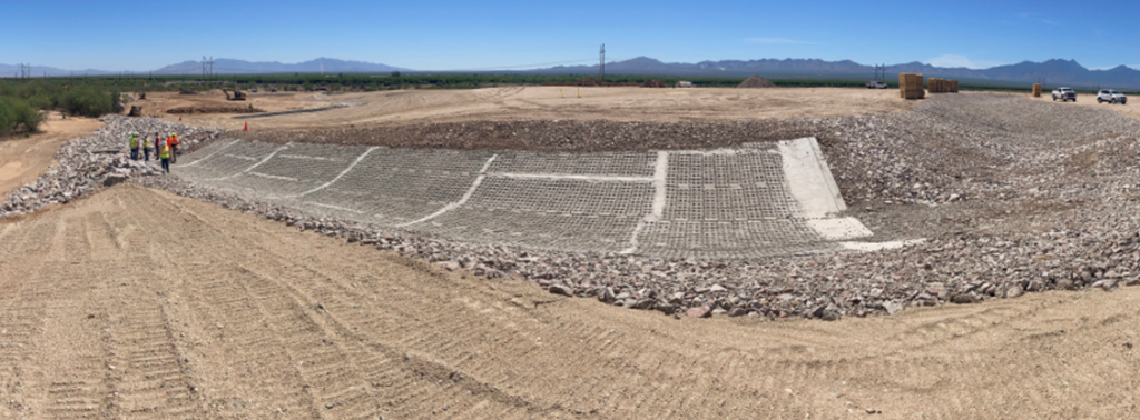
Figure 6-1. Articulated concrete-block–lined drainage channel installed as erosion control for the engineered cap.
Source: Arizona Department of Environmental Quality
Finally, the site was renovated into a public park. Recreational open space was designed in consultation with the Town, the Tohono O’odham Nation’s San Xavier District, the Wildlife Habitat Council, Discovery Education, Bat Conservation International, the Arizona-Sonora Desert Museum, and the Watershed Management Group. Features include 1.5 miles of walking trails, 14 trailside benches, two 20-foot-by-20foot steel ramadas, two traditional wa:ato (translated from the language of the Tohono O’odham, this means a ramada made of mesquite timbers), 2.5 acres of public gathering spaces, and parking areas. In addition, pollinator gardens were seeded, and vegetated areas were planted with native and culturally significant plants to attract bees, butterflies, and hummingbirds. Interpretive areas with informational signs and QR codes accompanied the planting areas. Bee blocks, to attract solitary bees, were also installed throughout the park. This park can serve as a STEM resource for hundreds of students at the two schools nearby. The park was formally opened to the public with a ribbon-cutting ceremony attended by Amax, Anaconda Arizona Inc., the Town, the Tohono O’odham Nation, and Arizona DEQ where the Tohono O’odham provided a blessing for the trail and park ( Freeport Minerals Corporation 2022 [ELKPG8T6] Freeport Minerals Corporation. 2022. “Parcel 30 Open Space Concept Proposal. September.” ).
6.2.2 Colorado – Kittimac Tailings Site, Bonita Peak Superfund Site
Value Proposition Statement. This case study describes a site, Kittimac Tailings Site, where it was proposed that the low pH, lead-contaminated tailings be mixed with high pH water treatment plant sludge from the Gladstone IWTP. This process was expected to help manage sludge from the IWTP and immobilize metals in the tailings—a net benefit for both sites. The mixed material would be placed in an on-site repository, capped with clean fill, and revegetated.
Background and Objectives. USEPA began treating discharge water from the Gold King Mine in October 2015 at the Gladstone IWTP in Gladstone, Colorado. Water was treated using a lime pH treatment to precipitate out dissolved metals from the additional discharge. Sludge generated at the IWTP was managed on-site. By early 2018, all available on-site sludge storage capacity was filled. In an effort to relocate IWTP sludge, a stand-alone abandoned tailings site, Kittimac Tailings, was identified as a high-priority recreational area with exposure to lead contamination (Figure 6-2).
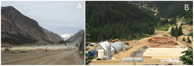
Figure 6-2. Kittimac Tailings Site pre-reclamation (A) and Gladstone Interim Water Treatment Plant
and Sludge Storage (B).
Source: Colorado Division of Reclamation, Mining and Safety (A) and
Colorado Department of Public Health and Environment (B)
The Gold King Mine IWTP sludge contains oxides of several metals, such as iron, zinc, and aluminum; lime, which is used to neutralize acidic mine drainage; and polymers, which are used to bind the particles together. The sludge passed the TCLP and thus is not considered a hazardous waste. Liquids associated with the sludge are also nonhazardous. Sludges and the associated water from the IWTP were managed safely on-site until storage capacity was reached.
Kittimac tailings contain metals that are a potential source of dissolved metals to the environment as found in samples taken on October 2016 and confirmed in samples taken on April 2018. In a focused treatability study, Mine Water Inc. tested the hypothesis that mixing silica-rich tailings from the Kittimac Site with metal oxides from the Gladstone IWTP would catalyze the mixture to a pH not more acidic than 11.0 s.u. (highly alkaline). This would result in beneficial pozzolanic reactions that would result in the binding and immobilization of metals. Gladstone IWTP sludge would be beneficial to the stability of metals in the resulting mixtures and result in at least incrementally lowered leachability of metals as measured by SPLP and by TCLP. A secondary objective was to determine whether freshly produced sludge was more reactive than older sludge stored at Gladstone for more than one year.
Study Method. Sludge and tailings samples were collected and mixed in various ratio mixtures for further analysis. The wash mixture was subsampled for analysis using TCLP and SPLP methods. TCLP analysis uses an organic acid mixture similar to the leachate that might be expected from a municipal solid waste (MSW) landfill. TCLP was tested for comparison if the treated mixture was disposed of into an MSW landfill. SPLP uses a pH 5.0 mixture of synthetic rainwater modified with sulfuric and nitric acids that generally correspond to rainfall that might result from poor air quality downwind of a coal-fired power plant emitting lots of sulfur oxides and nitrogen oxides. After extraction by each USEPA-approved Standard Method (1311 or 1312, as appropriate), the liquid fraction was analyzed for total metals.
Discussion of Results
Disposal of Gladstone IWTP sludge at MSW Landfill. TCLP extraction of Gladstone IWTP sludge demonstrated very high leachability for the following contaminants: aluminum, cadmium, cobalt, copper, magnesium, manganese, nickel, and zinc.
Each of these analytes were observed in the TCLP leachate at many orders of magnitude higher than observed in the predicted leachate when blended with Kittimac tailings. This indicated a beneficial effect of the blending process and a preferred type of disposal location (monofill vs. MSW landfill).
Beneficial reuse of Gladstone IWTP sludge as a treatment reagent. The aqueous stability of metals within the Kittimac tailings and stored in a monofill (no MSW leachate) was dramatically improved through addition of the Gladstone sludge to the Kittimac tailings. The Gladstone sludge was beneficial when incorporated at high pH levels into the Kittimac tailings for each metal element as measured by SPLP (Table 6-2). A few elements increased in leachable concentration, including aluminum, calcium, and potassium. These effects are not expected to be negative to the receiving environment but rather reflect the method of binding (using excess lime to dissolve the host rock and reprecipitate around the metal oxides). This reflects transitory and uncompleted reactions between the sludge and the tailings. The short duration of curing the blending mixtures is the likely cause of the uncompleted reactions, although it may take months for the full benefits of the reaction to be achieved. The soluble aluminum and calcium will tend to decrease over time (months) as the pozzolanic reactions continue to harden.
Fresh sludge proved better in binding lead and cadmium as measured under the TCLP extraction procedures. Aged sludge was better at binding lead, zinc, cadmium, and manganese as measured by SPLP leaching conditions. The differences in performance between aged sludge and fresh sludge were not significant for most metals in comparison to the huge benefits to the leachate quality of blending the sludge with the tailings (see Table 6-2).
Table 6-2. Summary of synthetic precipitation leachate procedure (SPLP) results
| Metal | Kittimac Tailings | 1.5:1 Fresh Sludge |
1:1 Tailings Aged |
1.5:1 Tailings Aged |
2:1 Tailings Aged |
Aged Sludge |
Tailings/ Mixture |
| Treatment Benefit | |||||||
| Lead | 5,400 | 9.10 | 2.90 | – | 2.90 | 2.90 | 0.1% |
| Barium | 52 | 31.00 | 18.00 | 47.00 | 12.00 | 2.80 | 23.1% |
| Copper | 660 | 160.00 | 100.00 | 160.00 | 92.00 | 2.20 | 13.9% |
| Cadmium | 4.4 | 0.16 | 0.16 | 0.16 | 0.16 | 0.16 | 3.6% |
| Iron | 290 | 48.00 | 31.00 | 31.00 | 31.00 | 31.00 | 10.7% |
| Magnesium | 480 | 78.00 | 93.00 | 49.00 | 69.00 | 11,000.00 | 10.2% |
| Manganese | 40 | 4.10 | 2.70 | 2.70 | 2.70 | 1,100.00 | 6.8% |
| Zinc | 810 | 7.30 | 5.80 | 5.80 | 5.80 | 5.80 | 0.7% |
| No Effect | |||||||
| Antimony | 3.4 | 3.40 | 3.40 | 3.40 | 3.40 | 3.40 | 100.0% |
| Arsenic | 4.1 | 4.10 | 4.10 | 4.10 | 4.10 | 4.10 | 100.0% |
| Beryllium | 0.33 | 0.33 | 0.33 | 0.33 | 0.33 | 0.33 | 100.0% |
| Chromium | 2.4 | 4.80 | 4.30 | 3.20 | 4.70 | 1.20 | 133.3% |
| Cobalt | 0.55 | 0.55 | 0.55 | 0.55 | 0.55 | 0.55 | 100.0% |
| Mercury | 0.07 | 0.07 | 0.07 | 0.07 | 0.07 | 0.07 | 100.0% |
| Nickel | 1.5 | 1.50 | 1.50 | 1.50 | 1.50 | 1.50 | 100.0% |
| Selenium | 3.6 | 3.60 | 4.90 | 3.60 | 3.80 | 3.60 | 100.0% |
| Silver | 0.85 | 0.85 | 0.85 | 0.85 | 0.85 | 0.85 | 100.0% |
| Thallium | 2.9 | 2.90 | 2.90 | 2.90 | 2.90 | 2.90 | 100.0% |
| Vanadium | 7.7 | 7.70 | 7.70 | 7.70 | 7.70 | 7.70 | 100.0% |
| Incomplete Reaction | |||||||
| Aluminum | 36 | 20,000.00 | 30,000.00 | 6,000.00 | 26,000.00 | 36.00 | 16,666.7% |
| Calcium | 3,800 | 88,000.00 | 82,000.00 | 100,000.00 | 70,000.00 | 76,000.00 | 1,842.1% |
| Potassium | 910 | 3,100.00 | 2,800.00 | 3,100.00 | 1,300.00 | 400.00 | 142.9% |
Note: Concentrations in micrograms per liter (µg/L).
Study Result Recommendations. The addition of one part by volume of Gladstone sludge (either fresh or aged) to Kittimac tailings was shown to have a very beneficial effect on the stability of metals in the Kittimac tailings. It was important that the pH be uniformly elevated (above pH 11, and preferably about 11.5–12) through the addition of lime, and that the tailings be intimately mixed with the sludge through a multiple pass tilling or rototilling method. Paste pH was used as an easy and rapid field method (within a few minutes) to gauge the effectiveness of the lime amendment/catalytic process. It was found that if the lime was added to the sludge at Gladstone, it acted as a surrogate for the overall mixing process. Moreover, if the pH was found to be elevated above 11 compared to the starting pH of around 4.8 s.u. for Kittimac tailings, then mixing could be presumed to be sufficient during the placement process (Figures 6-3, 6-4, 6-5, 6-6, and 6-7). More information can be found in the Action Memorandum ( USEPA 2017 [JQVJHR4A] USEPA. 2017. “Action Memorandum. Request for Approval of a Non-Time Critical Removal Action at the Bonita Peak Mining District. NPS Site ID# Con000802497.” U.S. Environmental Protection Agency. https://response.epa.gov/sites/12109/files/08-1834188.pdf. ), Fact sheet ( USEPA 2018 [XN5NDSB4] USEPA. 2018. “Bonita Peak Mining District. Interim Sludge Management.” U.S. Environmental Protection Agency. https://semspub.epa.gov/work/08/100004554.pdf. ), and Q&As ( USEPA 2018 [MGNAQWJL] USEPA. 2018. “Bonita Peak Mining District. Interim Sludge Management Q&As.” U.S. Environmental Protection Agency. https://semspub.epa.gov/work/08/100004830.pdf. ) for the Bonita Peak site.
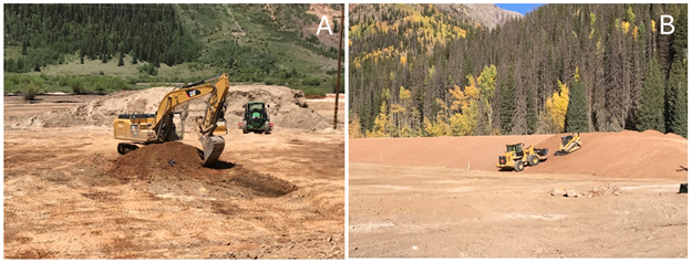
Figure 6-3. Kittimac tailings sludge and tailings mixing (A) and tailings berm construction (B).
Source: U.S. Environmental Protection Agency
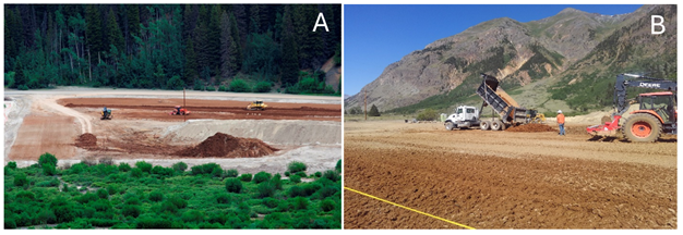
Figure 6-4. (A) Kittimac tailings sludge and tailings stockpile (B) and sludge transportation during reclamation.
Source: U.S. Environmental Protection Agency
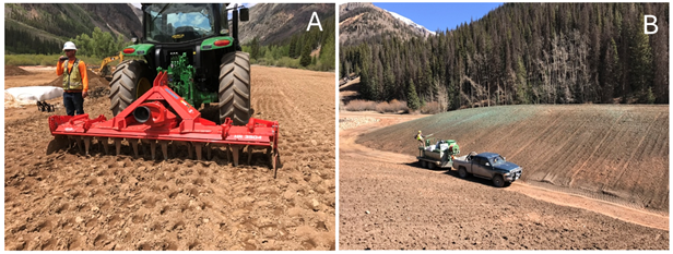
Figure 6-5. Kittimac tailings revegetation (A) and reseeded monofill (B).
Source: U.S. Environmental Protection Agency
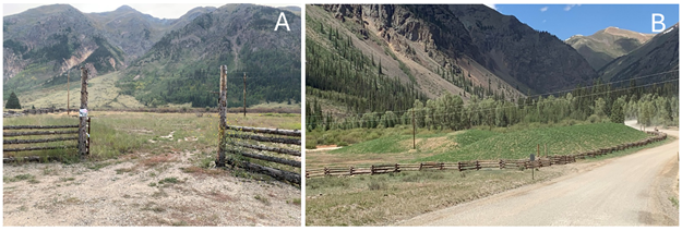
Figure 6-6. Kittimac reclaimed and revegetated (A) and reclaimed and revegetated monofill (B).
Source: Colorado Department of Public Health and Environment
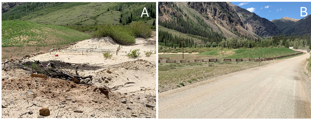
Figure 6-7. Kittimac reclaimed and revegetated berm and historic untouched narrow gauge train spur (A) and Kittimac Site reclaimed and revegetated (B).
Source: Colorado Department of Public Health and Environment
6.2.3 Michigan – Copper Mine Tailings on the Keweenaw Peninsula, Torch Lake Superfund Site
Value Proposition Statement. Historic copper mining left tons of tailings material, or stamp sands, in the Keweenaw Peninsula of Michigan. The stamp sands have elevated levels of copper and other metals. Stamp sands have been reused in a variety of construction and consumer products that capitalize on their basaltic base and residual copper concentrations.
Introduction. Starting in the 1800s, large deposits of native copper were discovered and mined in the Keweenaw Peninsula of Michigan. This area became one of the largest mining regions in North America, with operations continuing through the late 1990s. Metallic copper was extracted from the ore with the aid of steam-driven stamp mills, which crushed the rock to liberate the copper metal from the host rock. Approximately 500 million tons of host rock waste material, called stamp sands or tailings, were dumped in the interior waterways of the Keweenaw Peninsula and along the shorelines of Lake Superior. The major copper tailings dump sites include Torch Lake, Boston Pond, Freda-Redridge, Portage Lake, and Gay (Figure 6-8). These mining-related wastes occur both on the uplands and in the lakes and waterways, and mainly remain in form of stamp sands ( Jeong 2003 [9MP8YXJG] Jeong, Jae Beong. 2003. “Solid-Phase Speciation of Copper in Mine Wastes.” Bulletin of the Korean Chemical Society 24 (2): 209–18. https://doi.org/10.5012/BKCS.2003.24.2.209. ; Kerfoot and Nriagu 1999 [HZWVY3QH] Kerfoot, Charles W., and Jerome O. Nriagu. 1999. “Copper Mining, Copper Cycling and Mercury in the Lake Superior Ecosystem: An Introduction.” Journal of Great Lakes Research 25 (4): 594–98. https://doi.org/10.1016/S0380-1330(99)70764-1. ; Kerfoot et al. 2019 [PNQASCXD] Kerfoot, Charles W., Martin M. Hobmeier, Sarah A. Green, et al. 2019. “Coastal Ecosystem Investigations with LiDAR.” Remote Sensing 11 (9). https://doi.org/10.3390/rs11091076. ; Michigan DNR 2017 [2AUDR732] Michigan DNR. 2017. “A Historical Look at Copper Mining Stamp Sands and Buffalo Reef.” Showcasing the DNR. https://content.govdelivery.com/accounts/MIDNR/bulletins/1c80db4. ). The large quantities of copper mine tailings have had a negative environmental effect in the area. Those tailings deposited on shorelines are drifting along the lakeshore and affecting the beauty and ecological system of the otherwise pristine coastline of Lake Superior ( Kerfoot et al. 2009 [QKXFHMYW] Kerfoot, Charles W., Jaebong Jeong, and John A. Robbins. 2009. “Lake Superior Mining and the Proposed Mercury Zero-Discharge Region.” In State of Lake Superior, edited by M. Munawar and I. F. Munawar. Michigan State University Press. https://doi.org/10.14321/j.ctt13x0pcx.12. ; Kerfoot et al. 2019 [PNQASCXD] Kerfoot, Charles W., Martin M. Hobmeier, Sarah A. Green, et al. 2019. “Coastal Ecosystem Investigations with LiDAR.” Remote Sensing 11 (9). https://doi.org/10.3390/rs11091076. ; Raymond 2022 [JQ2QJ5GJ] Raymond, Ben. 2022. “EGLE Releases Concept for Buffalo Reef Jetty in Lake Superior Stamp Sand Plan |.” UP Matters. WJMN. https://www.upmatters.com/news/estimated-billion-dollar-buffalo-reef-stamp-sand-plan-announced/. ).
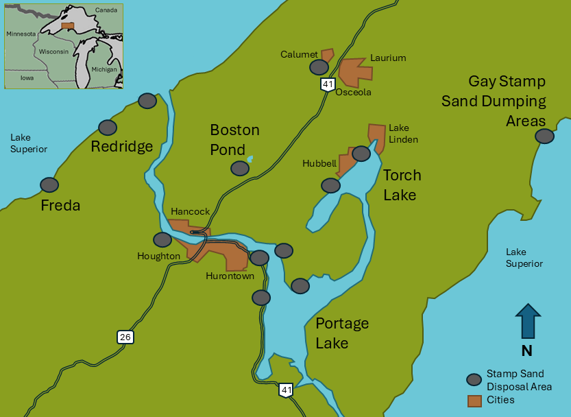
Figure 6-8. Major copper tailings dump sites in the Keweenaw Peninsula, Michigan.
Source: Interstate Technology & Regulatory Council Reuse of Solid Mining Waste Team
Copper is one of the trace elements essential to the health of plants and animals. The concentration of copper in stamp sands in Torch Lake and Gay reach 0.2%–0.6% in weight ( Jeong et al. 1999 [TARCXFUJ] Jeong, Jae Beong, Noel R. Urban, and Sarah Green. 1999. “Release of Copper from Mine Tailings on the Keweenaw Peninsula.” Journal of Great Lakes Research 25 (4): 721–34. https://doi.org/10.1016/S0380-1330(99)70772-0. ; Popko 2007 [2JMZDSJK] Popko, Dominic. 2007. “Minerals Recovery of Copper Mine Tailings on Lake Superior Coastline for Use as Raw Material in the Manufacture of Roofing Shingles | Research Project Database | Grantee Research Project | ORD | US EPA.” U.S. Environmental Protection Agency. https://cfpub.epa.gov/ncer_abstracts//index.cfm. ). The elevated concentrations of copper are toxic to aquatic organisms such as algae, benthic invertebrates, and juvenile fish ( Kerfoot et al. 2004 [CZUF4F2X] Kerfoot, Charles W., S. L. Harting, J. Jeong, John A. Robbins, and Ronald Rossmann. 2004. “Local, Regional, and Global Implications of Elemental Mercury in Metal (Copper, Silver, Gold, and Zinc) Ores: Insights from Lake Superior Sediments.” Journal of Great Lakes Research, ahead of print. https://doi.org/10.1016/S0380-1330(04)70384-6. ). A major metal halo has formed around the Keweenaw Peninsula ( Gewurtz et al. 2008 [9LU2X7J5] Gewurtz, Sarah B., Li Shen, Paul A. Helm, et al. 2008. “Spatial Distributions of Legacy Contaminants in Sediments of Lakes Huron and Superior.” Journal of Great Lakes Research 34 (1): 153–68. https://doi.org/10.3394/0380-1330(2008)34. ; Kerfoot and Nriagu 1999 [HZWVY3QH] Kerfoot, Charles W., and Jerome O. Nriagu. 1999. “Copper Mining, Copper Cycling and Mercury in the Lake Superior Ecosystem: An Introduction.” Journal of Great Lakes Research 25 (4): 594–98. https://doi.org/10.1016/S0380-1330(99)70764-1. ). The erosion and physical migration of metals-containing stamp sands also severely threatens the aquatic organisms living on the lake bottom and their habitats ( Chiriboga 2008 [2CRPAGUB] Chiriboga, Esteban. 2008. “Monitoring the Distribution and Movement of Mine Wastes in Lake Superior.” ).
Since the 1970s, Michigan’s Water Resources Commission, the Michigan DNR, and the USEPA have undertaken several remedial activities in the Great Lakes Area of Concern (AOC). This AOC is also a superfund site. The AOC spans the lower portion of the peninsula and its western Lake Superior shoreline, a total of approximately 368 square miles in Houghton County, Michigan ( USEPA 2023 [TCYSK9WP] USEPA. 2023. “Fifth Five-Year Review Report for Torch Lake Superfund Site Houghton County, Michigan.” https://www.epa.gov/superfund/search-superfund-five-year-reviews. ). Although some sites of the contaminated stamp sands in the AOC have been covered with soils and planted with vegetation ( Huang et al. 2005 [S9CV5UP2] Huang, Jianwei, Brenda R. Jones, Rich Henry, and David W. Charters. 2005. “Phytostabilization and Habitat Restoration of Copper-Contaminated Mine Tailings.” 2005 Third International Phytotechnologies Conference. USEPA CLU-in: U.S. Environmental Protection Agency. https://clu-in.org/phytoconf/agenda.cfm. ), the uncovered stamp sand piles, such as in Gay, are still eroding into the water. The covered stamp sands also continue loading metals into the lake and waterways via groundwater pathways (stacked stamp sands contain high penetrated porosity), threatening the ecosystem of Lake Superior ( Kerfoot et al. 2004 [CZUF4F2X] Kerfoot, Charles W., S. L. Harting, J. Jeong, John A. Robbins, and Ronald Rossmann. 2004. “Local, Regional, and Global Implications of Elemental Mercury in Metal (Copper, Silver, Gold, and Zinc) Ores: Insights from Lake Superior Sediments.” Journal of Great Lakes Research, ahead of print. https://doi.org/10.1016/S0380-1330(04)70384-6. ; Kerfoot et al. 2019 [PNQASCXD] Kerfoot, Charles W., Martin M. Hobmeier, Sarah A. Green, et al. 2019. “Coastal Ecosystem Investigations with LiDAR.” Remote Sensing 11 (9). https://doi.org/10.3390/rs11091076. ).
Among these sites, approximately 22.7 million metric tons of stamp sands have been dumped on the shoreline of the Gay site ( USGS 2019 [7S9NPNQ5] USGS. 2019. “Mapping the Stamp Sands of Lake Superior.” U.S. Geological Survey, Coastal and Marine Hazards and Resources Program. https://www.usgs.gov/programs/cmhrp/news/mapping-stamp-sands-lake-superior. ). Since then, the stamp sand piles have gradually eroded and migrated along the shoreline as far as 5 miles to the south. The extended concrete bank of the Big Traverse River acts as a barrier inhibiting further movement of the stamp sands. It is estimated that more than 85% of the original pile of stamp sands has been eroded ( USGS 2019 [7S9NPNQ5] USGS. 2019. “Mapping the Stamp Sands of Lake Superior.” U.S. Geological Survey, Coastal and Marine Hazards and Resources Program. https://www.usgs.gov/programs/cmhrp/news/mapping-stamp-sands-lake-superior. ). The tailings migration has covered the white sand beaches, decreasing the visual appeal of the area. Additionally, in Lake Superior the tailings are threatening Buffalo Reef, which is a critical lake trout and whitefish breeding ground, by filling up a trough in front of the reef and spilling over into the cobble beds around the reef ( Goldstein 2023 [PXA4H7XG] Goldstein, Bennet. 2023. “Great Lakes Pollution Threatens Ojibwe Treaty Rights to Fish.” Wisconsin Watch (Blog). February. https://wisconsinwatch.org/2023/02/. ; Kerfoot et al. 2019 [PNQASCXD] Kerfoot, Charles W., Martin M. Hobmeier, Sarah A. Green, et al. 2019. “Coastal Ecosystem Investigations with LiDAR.” Remote Sensing 11 (9). https://doi.org/10.3390/rs11091076. ; Yousef et al. 2013 [NXR3QCG9] Yousef, Foad, W. Charles Kerfoot, Colin N. Brooks, Robert Shuchman, Bruce Sabol, and Mark Graves. 2013. “Using LiDAR to Reconstruct the History of a Coastal Environment Influenced by Legacy Mining.” Remote Sensing of the Great Lakes and Other Inland Waters 39. https://doi.org/10.1016/j.jglr.2013.01.003. ). In recent years, many efforts from the USEPA; the National Oceanic and Atmospheric Administration; Michigan DNR; USACE; the Michigan Department of Environment, Great Lakes, and Energy (MI EGLE); environmental research institutions; Indian tribes; and the local community have focused on dredging the stamp sands from the water bodies ( Baxter 2022 [BLQT6X5A] Baxter, Samantha. 2022. “Restoring Buffalo Reef in Lake Superior.” FishSens Magazine. https://www.fishsens.com/ecologists-work-to-restore-lake-superior-reef-for-native-fish/. ; Hayter et al. 2015 [EUGNACL7] Hayter, Earl, Ray Chapman, Lihwa Lin, et al. 2015. “Modeling Sediment Transport in Grand Traverse Bay, Michigan, to Determine Effectiveness of Proposed Revetment at Reducing Transport of Stamp Sands onto Buffalo Reef.” U.S. Army Corps of Engineers. https://www.historicalgis.com/uploads/6/8/8/2/68821567/stamp_sands_letter_report.pdf. ; Kerfoot et al. 2016 [YATUFFVI] Kerfoot, Charles W., Noel R. Urban, Cory P. McDonald, Ronald Rossmann, and Huanxin Zhang. 2016. “Legacy Mercury Releases during Copper Mining near Lake Superior.” Journal of Great Lakes Research 42 (1): 50–61. https://doi.org/10.1016/j.jglr.2015.10.007. ; {zotpress items=”{4889498:86GQ5WFH}” style=”chicago-author-date”]; Michigan EGLE 2021 [TZPLDX4S] Michigan EGLE. 2021. “Progress Being Made to Remove Stamp Sands in Keweenaw Peninsula Affecting Buffalo Reef in Lake Superior.” Progress Being Made to Remove Stamp Sands in Keweenaw Peninsula Affecting Buffalo Reef in Lake Superior. https://www.michigan.gov/egle/newsroom/mi-environment. ; Raymond 2022 [JQ2QJ5GJ] Raymond, Ben. 2022. “EGLE Releases Concept for Buffalo Reef Jetty in Lake Superior Stamp Sand Plan |.” UP Matters. WJMN. https://www.upmatters.com/news/estimated-billion-dollar-buffalo-reef-stamp-sand-plan-announced/. ; Zanko et al. 2013 [UYSCT7FW] Zanko, L. M., M. M. Patelke, and P. Mack. 2013. Keweenaw Peninsula (Gay, Michigan) Stamp Sand Area Assessment. Natural Resources Research Institute, University of Minnesota-Duluth. ). Storing a large volume of tailings in a manner that will not adversely affect the lake or waterways is a challenge, not to mention a critical cost.
Mining Reuse Application. The giant pile of stamp sands on the shoreline at the Gay site is a related mining by-product. The stamp sands may be recycled and reused. The specific characteristics of stamp sands piled on the Keweenaw Peninsula depend on their mining origins; however, the major component of the stamp sands in this area is granular basaltic rock. The primary chemical composition of stamp sands includes SiO2, Al2O3, Fe2O3, CaO, MgO, and Na2O ( Li et al. 2010 [HQ37IRXX] Li, Bowen, Jiann-Yang Hwang, Jaroslaw Drelich, Domenic Popko, and Susan Bagley. 2010. “Physical, Chemical and Antimicrobial Characterization of Copper-Bearing Material.” JOM 62 (12): 80–85. https://doi.org/10.1007/s11837-010-0187-3. ). It contains plenty of naturally occurring metallic copper and trace elements. In addition, the particle size of the stamp sands makes it ready to be used as construction products ( Li et al. 2010 [HQ37IRXX] Li, Bowen, Jiann-Yang Hwang, Jaroslaw Drelich, Domenic Popko, and Susan Bagley. 2010. “Physical, Chemical and Antimicrobial Characterization of Copper-Bearing Material.” JOM 62 (12): 80–85. https://doi.org/10.1007/s11837-010-0187-3. ). These physical and chemical characteristics mean that recycled metal copper, which would be used in a wide variety of products, may potentially be produced from the stamp sands.
The stamp sand deposits in this area have been used to produce concrete blocks (by the Superior Block Company, a local construction materials company) and have been spread on the icy or snowy road surfaces in the winter season (by the Keweenaw County Road Commission). A research team from Michigan Technological University and Lesktech Ltd. investigating the stamp sands from the Gay area have demonstrated that particles sized between 8 and 50 mesh are ideal material for manufacturing roofing shingles ( Li et al. 2008 [E59V6RV3] Li, Bowen, Jiann-Yang Hwang, Rick Nye, Domenic Popko, and Peter E. O’Dovero. 2008. “Antibacterial Activity and Leaching Rate of Heavy Metals from Copper Tailings.” New Orleans, LA. ; Li et al. 2010 [HQ37IRXX] Li, Bowen, Jiann-Yang Hwang, Jaroslaw Drelich, Domenic Popko, and Susan Bagley. 2010. “Physical, Chemical and Antimicrobial Characterization of Copper-Bearing Material.” JOM 62 (12): 80–85. https://doi.org/10.1007/s11837-010-0187-3. ; Popko 2007 [2JMZDSJK] Popko, Dominic. 2007. “Minerals Recovery of Copper Mine Tailings on Lake Superior Coastline for Use as Raw Material in the Manufacture of Roofing Shingles | Research Project Database | Grantee Research Project | ORD | US EPA.” U.S. Environmental Protection Agency. https://cfpub.epa.gov/ncer_abstracts//index.cfm. ) and also verified that the stamp sand fines in the same area have excellent antimicrobial activity (against bacteria, fungi, and molds) owing to the high copper content in the tailing matrix. This research team also found that the stamp sands in this area would be a perfect raw material to produce high-performance aggregate products for road construction with asphalt pavement ( Li et al. 2013 [HFLTJQGF] Li, Bowen, Ralph Hodek, Dominic Popke, and Jiann-Yang Hwang. 2013. “Sustainable Applications of Stamp Sand in Keweenaw Peninsula of Michigan.” 142nd SME Annual Meeting (Denver, CO). ) and found potential uses as antimicrobial cement, sandblasting sand, pet mat sand, etc. The stamp sands are already crushed to the size of sand, which results in an overall energy savings of $8,000 per 1,000 tons of material used while reducing carbon dioxide emissions ( Popko 2007 [2JMZDSJK] Popko, Dominic. 2007. “Minerals Recovery of Copper Mine Tailings on Lake Superior Coastline for Use as Raw Material in the Manufacture of Roofing Shingles | Research Project Database | Grantee Research Project | ORD | US EPA.” U.S. Environmental Protection Agency. https://cfpub.epa.gov/ncer_abstracts//index.cfm. ). Further product development is ongoing.
6.2.4 Missouri – Madison County Mine Superfund Site
Value Proposition Statement. This case study describes a project where interested parties acquired a portion of a legacy mining site (the Madison County Mines [MCM] Superfund Site in Missouri) on the USEPA’s NPL and then worked with USEPA Region 7 and Missouri DNR staff to develop a plan to address environmental impacts, including reprocessing of historical tailing areas for critical minerals, mainly cobalt, nickel, and copper. Other related activities included the eventual closure of the historical tailing areas and reopening the mine.
Introduction. In March 2018, Missouri Mining Investments, LLC acquired land and operational control of 1,750 acres of the former Madison Mine operation in Madison County, Missouri, from the Anschutz Mining Corporation of Denver, Colorado ( USEPA 2019 [C6H94TQP] USEPA. 2019. “Administrative Settlement Agreement and Order on Consent for Removal Actions for Madison Mines Superfund Site, Operable Unit 2 with Missouri Mining Investments, LCC.” United States Environmental Protection Agency. ). This mine is operated by Missouri Cobalt, LLC, which does business as U.S. Strategic Metals (USSM) to better represent the full suite of metals (lithium, nickel, and copper) that it plans to produce. Missouri Cobalt holds a 100-year lease on the property from Missouri Mining Investments.
The MCM Superfund Site was added to USEPA’s NPL in September 2003. Missouri Cobalt, LLC and their partners/consultants, Environment Risk Transfer and Environmental Operations, worked collaboratively with USEPA Region 7 and Missouri DNR to develop a cleanup and site reuse plan for the site. In July 2019, former USEPA Administrator Andrew Wheeler made the following remarks while visiting the MCM Superfund Site to celebrate the twentieth anniversary of the Superfund Redevelopment Initiative.
“Missouri Cobalt saw the potential of the mine and put together a plan to take it over, clean it up, and get it back into productive use. This type of environmental risk transfer is a model we hope can be adopted at other sites around the country.”
Site Background. The MCM Superfund Site is in Fredericktown at the southern end of the Old Lead Belt in southeastern Missouri, approximately 90 miles south of St. Louis. The entire MCM Superfund Site encompasses approximately 520 square miles, which is approximately Madison County in its entirety, and includes the Mine La Motta Domain Tract that extends north into southern Saint Francois County.
The MCM Superfund Site is situated on the eastern edge of the Ozark Uplift within the Saint Francois Mountains. The core of the Ozark Uplift is formed by Precambrian crystalline rocks that are surrounded by Paleozoic and younger marine sedimentary strata. Topographically, the area exhibits a geologically mature landscape with rounded ridges and meandering streams that occupy comparatively wide valleys. In a few locations, rivers and streams cut across the ridges, forming steep canyons (Figure 6-9).
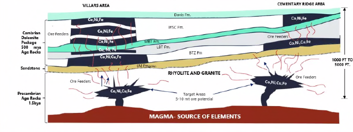
Figure 6-9. Conceptual geologic model of the Madison County Mines Superfund Site.
Source: Hall and Kennedy in Missouri Cobalt (
Missouri Cobalt 2023 [IXWZYFKC] Missouri Cobalt. 2023. “Securing America’s Resources for a Reliable, Green Future.” Missouri S&T’s Third Annual Critical Minerals Workshop (Rolla, MO).
)
Much of the MCM Superfund Site is underlain by Cambrian sedimentary rocks ( James 1949 [2PYS8VSZ] James, J. A. 1949. “Geologic Relationships of the Core Deposits in the Fredericktown Area, Missouri. State of Missouri, Division of Geological Survey and Water, Resources of Investigation, No. 8.” https://share.mo.gov/nr/mgs/MGSData/Books/Reports%20of%20Investigations/Geologic%20Relations%20of%20the%20Ore%20Deposits%20in%20the%20Fredericktown%20Area,%20Missouri/RI-008.pdf. ) that rest unconformably on a Precambrian basement complex composed of metamorphosed volcanic rocks and intrusive granites that are cut by occasional diabase dikes ( Tolman 1933 [NUID6GYH] Tolman, C. 1933. “The Geology of the Silver Mine Area, Madison County, Missouri. Reprint of Appendix I, 57th Biennial Report.” Missouri Bureau of Geology and Mines. ). The sedimentary rock formations vary in thickness and locally pinch out against structural highs in the basement complex. Bedrock formations in the area include the LaMotte Sandstone, Bonneterre Dolomite, Davis Formation, and Derby-Doe Run Dolomite, all of upper Cambrian age ( James 1949 [2PYS8VSZ] James, J. A. 1949. “Geologic Relationships of the Core Deposits in the Fredericktown Area, Missouri. State of Missouri, Division of Geological Survey and Water, Resources of Investigation, No. 8.” https://share.mo.gov/nr/mgs/MGSData/Books/Reports%20of%20Investigations/Geologic%20Relations%20of%20the%20Ore%20Deposits%20in%20the%20Fredericktown%20Area,%20Missouri/RI-008.pdf. ). Bedrock is overlain by only 50 to 150 feet of reddish clay overburden.
In the Mine LaMotte-Fredericktown subdistrict, lead-zinc-copper-cobalt mineralization occurs at about 250 to 400 feet from the surface in the lower Bonneterre Formation and the upper LaMotte Sandstone ( Missouri DNR 2023 [3PTPQDAI] Missouri DNR. 2023. “Cobalt.” Missouri Department of Natural Resources. https://oembed-dnr.mo.gov/document-search/cobalt-pub2893/pub2893. ). Ore bodies tend to be in arcuate shapes localized near pinch-outs of the LaMotte against buried Precambrian igneous knobs ( Missouri DNR 2023 [3PTPQDAI] Missouri DNR. 2023. “Cobalt.” Missouri Department of Natural Resources. https://oembed-dnr.mo.gov/document-search/cobalt-pub2893/pub2893. ). Metallic ore minerals mostly occur as deposits that have replaced dolomite crystals (Figure 6-10). These ore minerals occur as disseminated grains in horizontal sheets along bedding planes, cavity fillings, and linings on the walls of joints and fractures ( USGS et al. 1967 [C8GZTDLI] USGS, Missouri Division of Geological Survey and Water Resources, and USACE. 1967. “Mineral and Water Resources of Missouri, Volume XLIII, Second Series. April 6.” https://books.google.com/books?id=jiKG0AEACAAJ. ). Galena (PbS) is the primary ore mineral, which occurs with small amounts of sphalerite (ZnS), chalcopyrite (CuFeS2), siegenite ((Ni, Co)3S4), millerite (NiS), and bravoite ((Fe, Ni, Co)S2)) ( Missouri DNR 2023 [3PTPQDAI] Missouri DNR. 2023. “Cobalt.” Missouri Department of Natural Resources. https://oembed-dnr.mo.gov/document-search/cobalt-pub2893/pub2893. ; USGS et al. 1967 [C8GZTDLI] USGS, Missouri Division of Geological Survey and Water Resources, and USACE. 1967. “Mineral and Water Resources of Missouri, Volume XLIII, Second Series. April 6.” https://books.google.com/books?id=jiKG0AEACAAJ. . In the Precambrian basement complex, mineralized deposits within the intermediate igneous rocks may contain iron, cobalt, and copper-bearing minerals such as cobaltian pyrite ((Fe, Co)S2)) and carrollite (CuCo2S4) ( USEPA 2023 [Q3H8XV73] USEPA. 2023. “Third Five-Year Review Report for Madison County Mines Superfund Site, Madison County, Missouri. Prepared by USEPA Region 7.” U.S. Environmental Protection Agency. ).
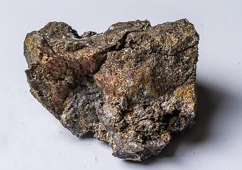
Figure 6-10. Sample of cobalt, copper, and nickel ore, Madison County.
Source: Missouri Department of Natural Resources (
USEPA 2023 [Q3H8XV73] USEPA. 2023. “Third Five-Year Review Report for Madison County Mines Superfund Site, Madison County, Missouri. Prepared by USEPA Region 7.” U.S. Environmental Protection Agency.
).
Based on past mining operations, at least 13 major areas of mining waste have been identified in the form of tailings and chat deposits from historical mineral processing operations and smelting activities ( USEPA 2023 [Q3H8XV73] USEPA. 2023. “Third Five-Year Review Report for Madison County Mines Superfund Site, Madison County, Missouri. Prepared by USEPA Region 7.” U.S. Environmental Protection Agency. ). Tailing deposits include silt- to sand-sized material resulting from the wet washing or flotation separation of the ore material. Chat deposits include sand- to gravel-sized material that is the result of crushing, grinding, and dry separation of the ore material. The mining waste contains elevated lead and other metals, which pose a threat to human health and the environment. These deposits have contaminated soils, sediments, surface water, and groundwater in Madison County. These materials were transported by wind and water erosion and manually relocated to other areas throughout the county. For example, mining waste and soils (contaminated from mining waste erosion) have been used on residential properties for fill material and private driveways, used as aggregate for road construction, and placed on public roads around Fredericktown to control snow and ice in the winter ( USEPA 2023 [Q3H8XV73] USEPA. 2023. “Third Five-Year Review Report for Madison County Mines Superfund Site, Madison County, Missouri. Prepared by USEPA Region 7.” U.S. Environmental Protection Agency. ).
The Madison Mine, originally discovered in the 1840s, underwent various periods of operation through 1961. The mined ore was extracted for lead, copper, cobalt, nickel, iron, zinc, and silver ( USEPA 2011 [DMI36587] USEPA. 2011. “Feasibility Study Report for Madison County Mines Superfund Site (OU1-OU3, OU5-OU6), Madison County, Missouri. Prepared by Black & Veatch Special Projects Corp.” U.S. Environmental Protection Agency. ). The mine operations consisted of three distinct surface and underground workings, with shafts reaching a maximum depth of 450 feet below the surface. During its peak production in 1956 (335,000 tons), the mine had the capacity to extract 2,268 metric tons of ore per day.
The MCM Superfund Site comprises multiple OUs. The portion of interest to this case study is OU-2 (the Anschutz OU), historically referred to as the Madison Mine or Madison Cobalt Mine. It consists of all mining and mine works locations immediately southeast of Fredericktown including tailing ponds, a metallurgical pond, an old mill, a smelter and associated slag pile, abandoned shafts, a mine decline, a metals refinery complex, a remnant chat pile and mine dump, associated groundwater, surface water, sediment contamination, and an abandoned rail spur ( USEPA 2023 [Q3H8XV73] USEPA. 2023. “Third Five-Year Review Report for Madison County Mines Superfund Site, Madison County, Missouri. Prepared by USEPA Region 7.” U.S. Environmental Protection Agency. ).
Mining Waste Reuse Summary. This section describes four main components of the mining waste reuse activities: (1) mining waste characterization methods and results, (2) regulatory considerations for mining waste reuse, (3) the target application for the reprocessed mining waste, and (4) the mining technologies involved in the reprocessing of the mining waste.
Solid Waste Characterization. The OU-2 tailings consists of five main tailings piles, totaling approximately 200 acres, which have been mostly characterized as brown-orange fine tailings covered with vegetative clay covers ( Anschutz Mining Corporation 2007 [QQBB7F5H] Anschutz Mining Corporation. 2007. “Draft NPDES Permit Renewal Application for Missouri Operating Permit MO-0098752.” Anschutz Mining Corporation. ). Several sampling events have been conducted to characterize the tailing piles since the 1990s ( Environmental Operations, Inc 2018 [KQXED83Q] Environmental Operations, Inc. 2018. “Preliminary Early Removal Action Work Plan. Madison Mines, Operable Unit 2 Modified. Prepared for Missouri Mining Investments, LLC.” ; Jacobs Engineering Group 1995 [Y8Q5APM9] Jacobs Engineering Group. 1995. “Final Expanded Site Inspection Report for Madison Mine Site, Fredericktown, Missouri. July.” Jacobs Engineering Group. ; USEPA 2011 [BI8IVALM] USEPA. 2011. “Supplemental Remedial Investigation Report for Madison County Mines Superfund Site (OU1-OU6), Madison County, Missouri. Prepared by Black & Veatch Special Projects Corp. April.” U.S. Environmental Protection Agency. ). Typically, these sampling efforts involved the use of direct-push cores to characterize the lithology and thickness of the tailings. Samples were collected for metals chemical analysis via USEPA Method 6020 or field screening with an XRF instrument. Elevated concentrations of cobalt, copper, iron, lead, manganese, and nickel exceeded USEPA screening criteria. Tailing piles were approximately 2 to 8 feet thick.
Between proven and inferred reserves, the Madison Underground Mine holds an estimated 9.3 million pounds of recoverable cobalt, likely making it the largest such reserve in North America. The site also contains an estimated 13 million pounds of nickel and 14 million pounds of copper. Existing tailings and underground deposits are expected to yield total run-rate production of at least 1.9 million pounds per year of cobalt, 2.6 million pounds per year of nickel, and 2.8 million pounds per year of copper when underground mining begins.
Regulatory Considerations. Between the mid-1980s and early 2000s, several initial environmental investigations were conducted, but negotiations between USEPA and potential responsible parties to continue those activities were unsuccessful ( USEPA 2019 [C6H94TQP] USEPA. 2019. “Administrative Settlement Agreement and Order on Consent for Removal Actions for Madison Mines Superfund Site, Operable Unit 2 with Missouri Mining Investments, LCC.” United States Environmental Protection Agency. ). In 2011, USEPA prepared draft Remedial Investigation and Feasibility Study Reports for the MCM Superfund Site ( USEPA 2011 [DMI36587] USEPA. 2011. “Feasibility Study Report for Madison County Mines Superfund Site (OU1-OU3, OU5-OU6), Madison County, Missouri. Prepared by Black & Veatch Special Projects Corp.” U.S. Environmental Protection Agency. ; USEPA 2011 [BI8IVALM] USEPA. 2011. “Supplemental Remedial Investigation Report for Madison County Mines Superfund Site (OU1-OU6), Madison County, Missouri. Prepared by Black & Veatch Special Projects Corp. April.” U.S. Environmental Protection Agency. ). The reports concluded that historical mining activities have impacted soil, groundwater, surface water, and sediment. In 2014, the U.S. Fish and Wildlife Service and Missouri DNR, acting as Trustees for the site, conducted a Preassessment Screen and Determination, which concluded that the release of hazardous substances has impacted the site’s natural resources and that Trustees may assert trusteeship under CERCLA and the Clean Water Act.
That step was not needed for OU-2 because in February 2019, Missouri Mining Investments, LLC voluntarily entered into an Administrative Settlement Agreement and Order of Consent with USEPA (for the 1,750-acre parcel acquired in 2018). The intent of Missouri Cobalt was to recycle existing tailings on the site into a useful product while ensuring all proper soils and hazardous waste management practices are followed, as part of their new business operations ( USEPA 2019 [C6H94TQP] USEPA. 2019. “Administrative Settlement Agreement and Order on Consent for Removal Actions for Madison Mines Superfund Site, Operable Unit 2 with Missouri Mining Investments, LCC.” United States Environmental Protection Agency. ).
In 1989, Missouri established the Metallic Minerals Waste Management Act (MMWMA), which regulates the disposal of solid waste from mining and processing of metallic minerals through permits issued by the Missouri DNR. Currently, USSM has a permit under the act for a 13-acre parcel of the site.
The general plan for reprocessing and closing the tailing piles involved the following activities, which were completed in late 2023:
- Removing the existing vegetative cover
- Removing some tailings material for reprocessing/recycling
- Confirmatory sampling to measure residual soil concentrations for chemicals of concern (including arsenic, cadmium, cobalt, copper, lead, nickel, and zinc)
- Installing a low-permeability vegetative cover (containing 18 inches of clay and 12 inches of topsoil) if residual concentrations remain above action levels
- Installing a clay cover sourced from an on-site borrow pit and sampling every 10,000 cubic yards for metals/chemicals of concern
Mining Reuse Application. OU-2 was acquired by USSM with the goal of producing large-scale quantities of battery-grade cobalt and nickel. Initially, some tailings will be reclaimed; subsequently, residuals will be capped, and additional subsurface mining will be performed.
USSM plans to build a metal crystal manufacturing plant at the site. This is an example of mining to manufacturing vertical integration to reduce costs and the carbon footprint associated with transportation.
Reprocessing Technologies. In 2019, Missouri Cobalt constructed a mine tailings processing facility to recover minerals from existing mining waste. Reprocessing the tailings produces valuable metals concentrates, including cobalt, while reducing the toxicity and volume of the mining waste (Figure 6-11).
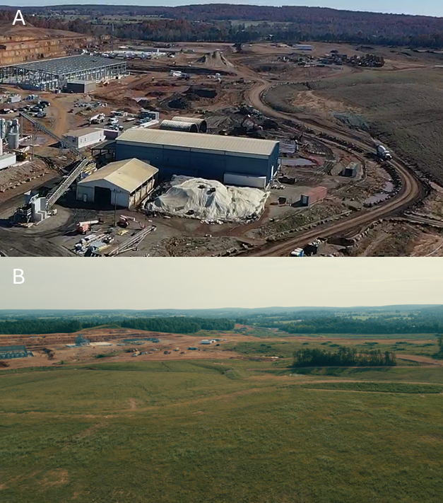
Figure 6-11. (A) Tailings concentrator and
(B) reclaimed tailings at U.S. Strategic Metals (USSM) site in Fredericktown, MO.
Source: U.S. Strategic Metals
A general description of the mining and concentrating tailings process is provided below:
- A long reach excavator removes tailings from the original deposited areas and loads a haul truck, which moves the material to the milling area stockpile.
- A loader reclaims tailings into the top of the pug mill where it is mixed with water to produce a tailings slurry. The slurry is then pumped into storage tanks before being pumped into a ball mill, where the tailings slurry is further ground to liberate valuable minerals from the host rock. The ball mill grinding process also creates fresh mineral surfaces that allow chemistry associated with the flotation stage to work better.
- The flotation process consists of eight rougher flotation cells and four cleaner flotation cells (Figure 6-12). The rougher cells receive the slurry from the ball mill circuit and produce a rough concentrate. The cleaner cells then receive the rougher concentrate that is the final product ready for drying.
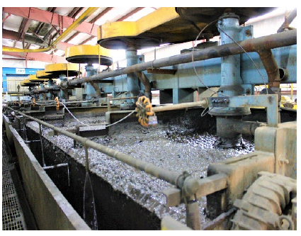
Figure 6-12. Flotation process.
Source: Missouri Cobalt (
Missouri DNR 2023 [3PTPQDAI] Missouri DNR. 2023. “Cobalt.” Missouri Department of Natural Resources. https://oembed-dnr.mo.gov/document-search/cobalt-pub2893/pub2893.
)
- The slurry moves from the cleaner flotation cell to the concentrate thickener, where it is thickened up in preparation for concentrate filtering and drying. The thickened slurry then goes through a filter press where some water is removed to produce a concentrated filter cake containing 15% to 20% moisture. The filter cake is then discharged to a collecting conveyor and then onto a Hollo-Flyte dryer. The filter cake concentrate is then temporarily stored in the concentrate storage building prior to shipment.
Hydrometallurgical Facility. In 2020, Missouri Cobalt opened a pilot hydrometallurgical facility in Earth City, Missouri (Figure 6-13). The company was successful in developing a process to recover cobalt-and nickel crystals from base metal concentrates and lithium battery scrap.
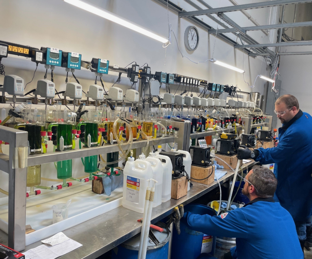
Figure 6-13. USSM staff working on cobalt and nickel crystals recovery pilot project.
Source: U.S. Strategic Metals.
A new hydrometallurgical facility is under construction at the site in Fredericktown, Missouri, to process scrap lithium battery material along with mineral concentrates from tailings, outside sources, and newly developed underground ore (Figure 6-14). Once operational, this will be the only cobalt processing facility in the U.S.
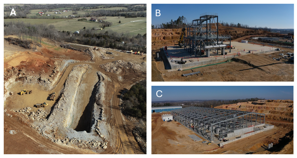
Figure 6-14. Construction of the new decline access (A), Hydrometallurgical crystallizer facility (B), and Hydrometallurgical solvent extraction facility (C).
Source: U.S. Strategic Metals
6.2.5 Montana – Anaconda Smelter Superfund Site, Old Works Operable Unit
Value Proposition Statement. This case study describes a project that integrates remediation of a historic copper smelting complex, historic preservation, recreational/economic reuse of the inactive lands, and use of a copper smelter by-product [slag] as part of the redevelopment, including a world-class golf course. The Old Works site is a good example of the integration of remedy, waste reuse, historic preservation, and redevelopment.
Site and Copper Smelting History. The Old Works OU located in Anaconda, Montana, contains large volumes of milling and smelting wastes, fallout from smelter emissions, and other wastes that originated from the operation of smelters at the Upper and Lower Works from 1884 to 1902. Remnants of six brick flues and deteriorated brick foundations are the last remnants of the original Old Works facilities ( USEPA 1994 [R954YGAN] USEPA. 1994. “EPA Superfund Record of Decision. Old Works/East Anaconda Development Area Site.” U.S. Environmental Protection Agency. https://nepis.epa.gov/Exe/tiff2png.cgi/91001SJQ.PNG?-r+75+-g+7+D%3A%5CZYFILES%5CINDEX%20DATA%5C91THRU94%5CTIFF%5C00001975%5C91001SJQ.TIF. ).
The Upper and Lower Works were the first copper smelting facilities built to process copper ore mined in nearby Butte, Montana. The Upper Works structural area was constructed in 1883/1884, and the Lower Works smelting facilities were built in 1888. The smelters were connected to brick stacks atop adjacent hills by concrete flues. Decommissioning started in 1902 and was completed about 1906. The smelting process included the processing of lower grade ore by crushing, screening, and jigging (agitation) to concentrate the ore material. The jig tailings were discharged onto the floodplain area. Heap roast slag, composed of vitrified material, was generated by processing efforts to recover target metals from discarded tailings. During the operating time, approximately 300,000 cubic yards of slag were produced and placed within the boundaries of the Old Works OU ( USEPA 1994 [R954YGAN] USEPA. 1994. “EPA Superfund Record of Decision. Old Works/East Anaconda Development Area Site.” U.S. Environmental Protection Agency. https://nepis.epa.gov/Exe/tiff2png.cgi/91001SJQ.PNG?-r+75+-g+7+D%3A%5CZYFILES%5CINDEX%20DATA%5C91THRU94%5CTIFF%5C00001975%5C91001SJQ.TIF. ). Several of the structures within the Old Works area were eligible for inclusion on the National Register of Historic Places, including the remaining Old Works structural areas and the heap roast slag.
Chemical Characteristics of the Tailings Site and the Black Slag. Primary COCs at the site were arsenic, lead, cadmium, copper, and zinc. Copper smelter slag typically consists of vitrified amorphous iron, silicon, aluminum, and calcium oxides and silicates with minor concentrations of heavy metals such as copper or zinc. A summary of the analytical results from the remedial investigation from the Old Works OU ROD reveals that the maximum concentration of arsenic found at the site was 10,400 mg/kg from a sample of flue debris. The maximum concentrations of other metals were 398 mg/kg cadmium (flue debris), 59,200 mg/kg copper (heap roast slag), 2,900 mg/kg lead (floodplain wastes), and 62,100 mg/kg zinc (Upper Works demolition debris). It was also noted that no samples exceeded TCLP criteria as a characteristic hazardous waste ( USEPA 1994 [R954YGAN] USEPA. 1994. “EPA Superfund Record of Decision. Old Works/East Anaconda Development Area Site.” U.S. Environmental Protection Agency. https://nepis.epa.gov/Exe/tiff2png.cgi/91001SJQ.PNG?-r+75+-g+7+D%3A%5CZYFILES%5CINDEX%20DATA%5C91THRU94%5CTIFF%5C00001975%5C91001SJQ.TIF. ).
Regulatory Considerations. The Anaconda Smelter Site was listed on the NPL in 1983 under the authority of CERCLA. Atlantic Richfield, as successor to the Anaconda Minerals Company, was named a PRP.
In 1994 the USEPA selected a remedy that required the construction of engineered controls to reduce surface arsenic concentrations to below the recreational action level of 1,000 ppm in current and potential future recreational use areas and below 500 ppm in current industrial areas. The controls consisted of regrading surface materials, building borrowed-soil covers, chemical treatment, storm water controls, infiltration controls, and revegetation treatments. Building the vegetated engineered soil covers required treatment techniques such as 18-inch tilling, lime additions, and soil amendments to reduce surface arsenic concentrations below the appropriate action levels; stabilizing waste material; and promoting a permanent vegetative cover. The wastes are consolidated and graded as necessary to reduce infiltration, control runoff, and minimize erosion. Large portions of the waste are underlain by hydraulic controls that include an extensive underdrain system where excess irrigation water is collected and recycled before it comes in contact with the waste or with groundwater. Portions of the heap roast slag remain uncovered to preserve historic integrity at the site. Additionally, wastes associated with historic structures were left in place and left uncovered because of inaccessibility and limited land use. Drainage controls were used to minimize runoff from the historic structure areas ( USEPA 1994 [R954YGAN] USEPA. 1994. “EPA Superfund Record of Decision. Old Works/East Anaconda Development Area Site.” U.S. Environmental Protection Agency. https://nepis.epa.gov/Exe/tiff2png.cgi/91001SJQ.PNG?-r+75+-g+7+D%3A%5CZYFILES%5CINDEX%20DATA%5C91THRU94%5CTIFF%5C00001975%5C91001SJQ.TIF. ).
Beneficial Reuse of the Black Copper Slag. Redevelopment work included the construction of the Old Works Golf Course. A unique and distinguishing feature of the golf course is the use of the black sand waste. This black sand is copper slag, a by-product of the copper smelting process (Figure 6-15). When copper is extracted from ore, the impurities are separated and discarded as slag. At the Old Works, this slag is used to create the black sand bunkers that are used throughout the course.
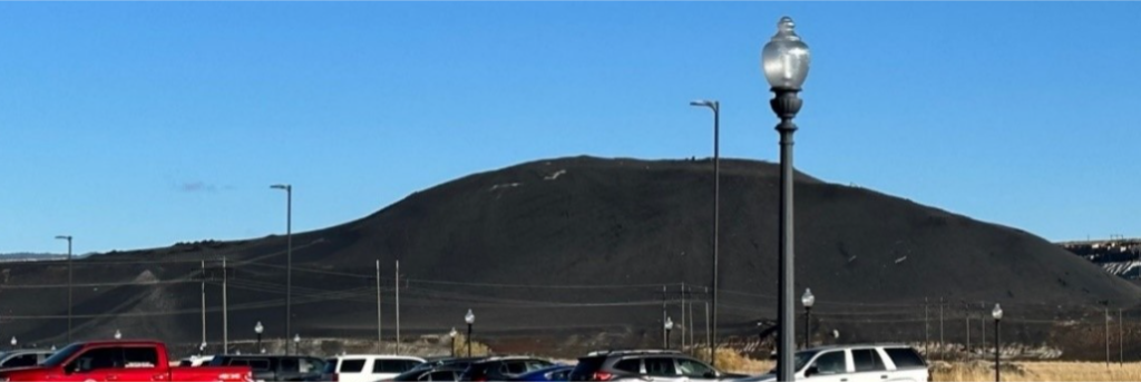
Figure 6-15. Black slag pile in Anaconda, Montana, in 2023.
Source: Robin Bullock, Montana Technological University
The use of black sand in the bunkers at the Old Works Golf Course is not only visually appealing but also serves a practical purpose. It is highly durable and resistant to erosion, ensuring that the bunkers maintain their shape and integrity over time. Additionally, the black color absorbs and retains heat, which helps to speed up the drying process after rainfall, allowing for quicker playability.
Community Recommendation Integration with Remedy. Between 1991 and 1994, the community of Anaconda-Deer Lodge held discussions with Atlantic Richfield, USEPA, and the State of Montana concerning the community’s desire to redevelop the Old Works area into a community asset. The Old Works area is in the central part of the community, only a few city blocks from the courthouse. This proximity drove a desire to work with the PRP and regulatory agencies to develop a community project that would assist in the revitalization of the community after cessation of the smelter operation. The community also noted their interest in retaining the historic smelter features and recommended construction of a golf course (Figure 6-16).
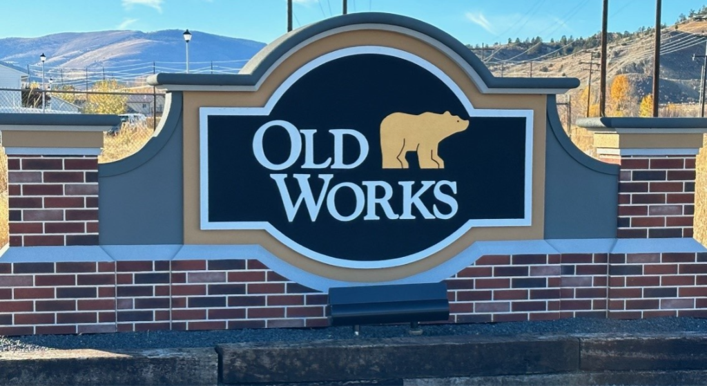
Figure 6–16. Old Works Golf Course.
Source: Robin Bullock Montana Technological University
Several notable golf course designers were interviewed by the county and the PRP prior to the selection of Jack Nicklaus. As noted on the Nicklaus Design website (Figure 6-17),
( Nicklaus Design [RGMXZ348] Nicklaus Design. n.d. “Old Works Golf Course.” Old Works Golf Course. https://nicklausdesign.com/course/oldworks/. )
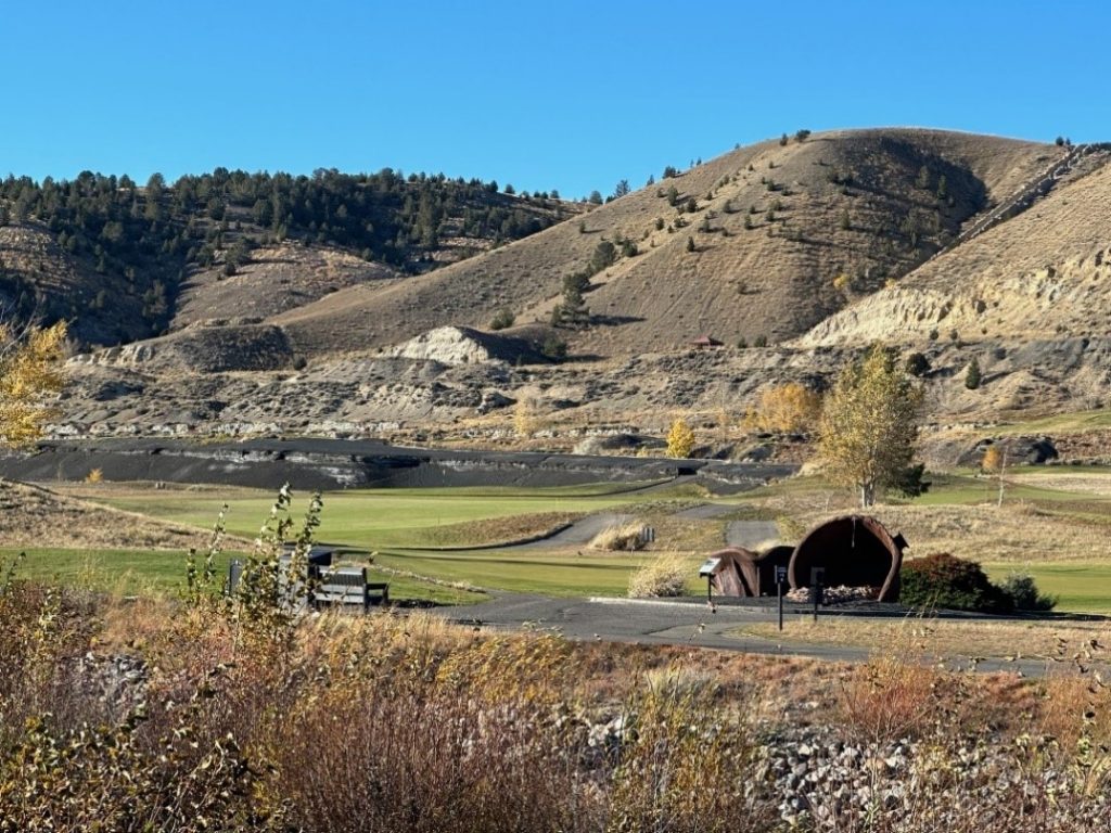
Figure 6-17. Old Works Golf Course in 2023 with black slag sand traps and heap roast slag shown.
Source: Robin Bullock Montana Technological University
6.2.6 Montana – Silver Bow Creek/Butte Area Superfund Site, Butte Mine Flooding Operable Unit
Value Proposition Statement. This case study describes a project that integrates active mine operations, superfund remediation, and critical mineral recovery as an integral part of each operation. The Mine Flooding site is a good example of how to integrate a remedy with critical and potential REE recovery.
Site and Mining History. The mines in Butte, Montana, began as a series of more than 400 underground copper, zinc, silver, manganese, and molybdenum mine operations with more than 10,000 miles of tunnels under the community of Butte ( Gammons and Icopini 2020 [ISAYRK8K] Gammons, Christopher H., and Gary A. Icopini. 2020. “Improvements to the Water Quality of the Acidic Berkeley Pit Lake Due to Copper Recovery and Sludge Disposal.” Mine Water and the Environment 39 (3). https://doi.org/10.1007/s10230-019-00648-8. ). By 1955, Anaconda Arizona Inc. had elected to pursue open-pit mining in what became the Berkeley Pit. Anaconda Arizona Inc. operated the Berkeley Pit facility until 1982, when it was closed by the successor to Anaconda Arizona Inc., Atlantic Richfield. By this time, the pit was 1,780 feet deep, covered 675 acres, and had an extensive groundwater extraction system. When the mine closed, the pumps were turned off, which allowed groundwater to begin refilling the mining complex ( USEPA 1994 [TYHYQ3RR] USEPA. 1994. “Record of Decision. Butte Mine Flooding Operable Unit. Silver Bow Creek/Butte Area NPL Site.” U.S. Environmental Protection Agency. https://semspub.epa.gov/work/HQ/188195.pdf. ).
The Butte Mine Flooding OU is part of the Silver Bow Creek / Butte Area site. Within the boundaries of the OU is part of an operating mine that recovers copper from water pumped from the Berkeley Pit and open-pit mining from a different deposit (the Continental Pit). The OU consists of waters within the flooded Berkeley Pit, the flooded underground mine workings hydraulically connected to the Berkeley Pit, the associated alluvial and bedrock aquifers, and other contributing sources of inflow to the Berkeley Pit. The Berkeley Pit is the lowest point in the hydrogeological system and acts as a hydraulic sink for water with high levels of metals and arsenic released as a result of the interactions between mineralized rock and mining waste with ground and surface waters ( USEPA 1994 [TYHYQ3RR] USEPA. 1994. “Record of Decision. Butte Mine Flooding Operable Unit. Silver Bow Creek/Butte Area NPL Site.” U.S. Environmental Protection Agency. https://semspub.epa.gov/work/HQ/188195.pdf. ). The remedial objectives at this OU include maintaining the elevation of the water in the Berkeley Pit below a critical water level (CWL) elevation of 5,410 feet (based on a USGS datum). The PRPs are required to maintain the CWL by means of surface water controls and water treatment/discharge to protect Silver Bow Creek from receiving contaminated water from the OU ( USEPA 1994 [TYHYQ3RR] USEPA. 1994. “Record of Decision. Butte Mine Flooding Operable Unit. Silver Bow Creek/Butte Area NPL Site.” U.S. Environmental Protection Agency. https://semspub.epa.gov/work/HQ/188195.pdf. ).
Chemical Characteristics of the Berkeley Pit. Water in the Berkeley Pit contains high levels of metals and arsenic as a result of water levels rising in the mine workings and from contaminated surface water inflows from the tailings impoundment (Table 6-3). The source of the contamination is AMD, which results from the oxidation of sulfide minerals in the presence of oxygen ( USEPA 1994 [TYHYQ3RR] USEPA. 1994. “Record of Decision. Butte Mine Flooding Operable Unit. Silver Bow Creek/Butte Area NPL Site.” U.S. Environmental Protection Agency. https://semspub.epa.gov/work/HQ/188195.pdf. ).
Table 6-3. Average concentrations of chemicals of concern in the Berkeley Pit, 1991 and 2024
| Chemicals of Concern | Average Concentrations as Noted in the USEPA Record of Decision – 1991 (ug/L) | Average Concentrations May 2024 Montana Bureau of Mines and Geology (ug/L) |
| Aluminum | 270,000 | 245,143 |
| Arsenic | 710 | 8.17 |
| Cadmium | 1,790 | 2,183 |
| Copper | 167,000 | 58,233 |
| Iron | 897,000 | 1,272 |
| Magnesium | 395,000 | 621,933 |
| Manganese | 161,000 | 27,516 |
| pH (s.u.) | 3.0–3.3 | 4.45–4.48 |
| Sulfate | 16,800,000 | 6,383,666 |
| Zinc | 476,000 | 593,800 |
Sources: MBMG ( MBMG 2024 [W5VI3LGP] MBMG. 2024. “Montana’s Ground Water Information Center 2024.” Montana Bureau of Mines and Geology. https://mbmggwic.mtech.edu/. ), USEPA (1994b)
Regulatory Considerations. The Butte Mine Flooding OU is part of the Silver Bow Creek / Butte Area Superfund Site and is in the city of Butte, Montana. It consists of waters within the Berkeley Pit, the underground mine workings hydraulically connected to the Berkeley Pit, the associated alluvial and bedrock aquifers, and other contributing sources of inflow to the Berkeley Pit. A major seepage area originates in the Horseshoe Bend (HSB) area and is a result of seeps from the Yankee Doodle tailings impoundment.
The remedy selected by the USEPA seeks to maintain the elevation of Berkeley Pit water below the CWL and prevent discharge of untreated water to Silver Bow Creek. The remedy includes capture and treatment of water from the HSB seeps and the Berkeley Pit using high-capacity pumps and high-density sludge (HDS) treatment technology. The HDS water treatment plant uses lime to raise the pH of the influent and promote the precipitation of metals as hydroxides that are sequestered in sludge that is discharged back to the Berkeley Pit. Thanks to cooperation between the USEPA, the Montana DEQ, and the PRPs regarding the superfund site and the mining permit requirements, the HDS treatment sludge is allowed to be reused, and the MIW water treated by the HDS plant is reused in the active mine process, thereby also reducing the flow of fresh water required for mine operations ( Arcadis U.S., Inc. 2019 [NP637KFK] Arcadis U.S., Inc. 2019. “BMF OU Remedial Action Adequacy Report. Draft Final RAAR Technical Memorandum.” ). Similar cooperative efforts have allowed for copper recovery from the Berkeley Pit in response to several public comments (captured in the ROD; USEPA 1994e) that requested the remedy also allow for metal recovery from the treatment process. Copper recovery from Berkeley Pit water has been ongoing since the late 1990s (see Section 6.1.7.4).
Since 2019, additional treatment capacity was installed as part of a pilot study initiated by the PRPs and sanctioned by the USEPA with concurrence from the Montana DEQ. The additional treatment capacity involves treatment and discharge of water from the tailings impoundment to Silver Bow Creek while increasing the amount of Berkeley Pit water that is reused by the active mine. This cooperative effort has maintained the elevation of water in the Berkeley Pit well below the CWL, optimized the output from the HSB water treatment plant, increased the amount of water reused by the active mine, and allowed Atlantic Richfield to build an additional water treatment plant that discharges treated water to Silver Bow Creek ( Saks [ZQJ6K5YD] Saks, Nora. n.d. Butte Reaches Superfund Milestone, Releasing Berkeley Pit Water Into Silver Bow Creek. Montana News. Accessed September 9, 2024. https://www.mtpr.org/montana-news/2019-10-01/butte-reaches-superfund-milestone-releasing-berkeley-pit-water-into-silver-bow-creek. ).
Mine Water Treatment and Sludge Reuse. Between 1994 and 2001, water from HSB was used in the mine process after some treatment. In 2001, due to the need for water to support intermittent mining operations, design and construction of the HSB water treatment plant was initiated. The HSB water treatment plant was built and operated by Atlantic Richfield and Montana Resources with a nominal treatment capacity of 7 million gallons per day and has operated continuously since 2003 (Figure 6-18).
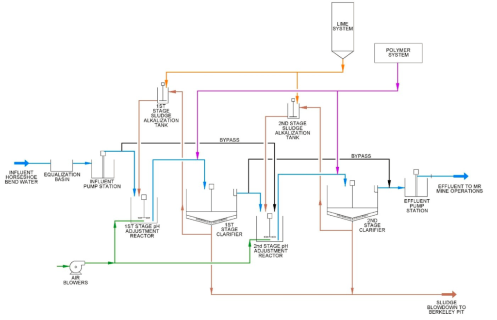
Figure 6-18. Horseshoe Bend water treatment process.
Source: Arcadis (
Arcadis U.S., Inc. 2019 [NP637KFK] Arcadis U.S., Inc. 2019. “BMF OU Remedial Action Adequacy Report. Draft Final RAAR Technical Memorandum.”
)
Since the initiation of water treatment at the HSB HDS water treatment plant, sludge from the water treatment plant was disposed of by submergence within the Berkeley Pit water body. In the 1990s, pH in the Berkeley Pit was extremely acidic with an average range of 2.55 to 3.3 pH. As a result of disposal of treatment sludge with excess NP (in the form of magnesium hydroxide) into the pit for more than two decades, the average pH of the pit has continued to increase over time. As of 2024, the pH in the pit is greater than 4.0 s.u., resulting in precipitation of the majority of iron and arsenic and a decrease in metals concentrations (see Table 6-3).
Critical Mineral Recovery. In 1985 Montana Resources began mine operations in the Continental Open Pit. The Montana Resources concentrator is located near the south rim of the Berkeley Pit. Ore from the Continental Pit, located east of the Berkeley Pit, is milled and processed at the concentrator. The milling process uses water decanted from the tailings pond, imported water, water treated at the HSB water treatment system, and excess water pumped from the Continental Pit area (Figure 6-19).
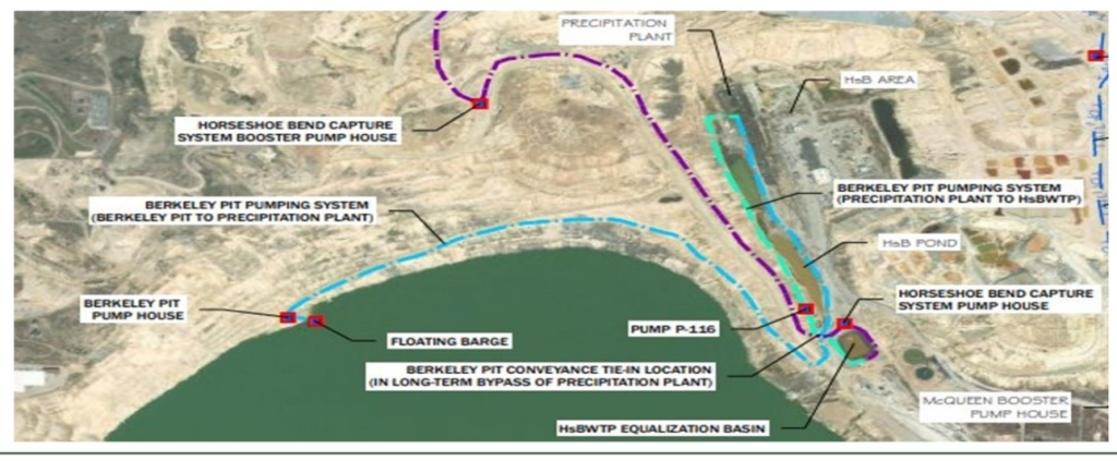
Figure 6-19. Montana Resources mine water flow.
Source: Ingersoll et al. (
Ingersoll et al. 2023 [2326EHUN] Ingersoll, M., L. Teagan, and R. Bullock. 2023. “Critical Recovery from Acid Mine Water.” Proceedings of the 2023 MinExchange Conference of the Society of Mining and Exploration (Denver, CO).
)
The copper recovery system uses iron flumes filled with scrap iron and inundated with acidified water from the Berkeley Pit ( Gammons and Icopini 2020 [ISAYRK8K] Gammons, Christopher H., and Gary A. Icopini. 2020. “Improvements to the Water Quality of the Acidic Berkeley Pit Lake Due to Copper Recovery and Sludge Disposal.” Mine Water and the Environment 39 (3). https://doi.org/10.1007/s10230-019-00648-8. ). At very low pH, copper in solution exchanges for ferrous iron in the scrap; iron goes into solution, and elemental copper precipitates out. After sufficient contact time, the remaining iron is raised magnetically to dislodge the precipitate. The precipitate is then washed into the settling tanks at the end of the flumes. After flowing through the flumes, the water is pumped for secondary extraction. Approximately 80% to 95% of the copper content is recovered in the flumes (see Section 6.1.7.4).
In addition to the copper recovery process, the responsible parties continue to explore additional opportunities for mineral recovery. In 2023 Montana Technological University and West Virginia University, in cooperation with Montana Resources and Atlantic Richfield, began evaluating opportunities to recover critical elements from the Berkeley Pit and from the HDS sludge, respectively (Table 6-4).
Table 6-4. Metal concentrations in water and sludge
| Sample Location | Al | As | Be | Ce | Co | Cr | La | Li | Mn | Nd | Ni | Pd | Pr | Rb | Ti | Zn |
| Horseshoe Bend Seep (µg/L) |
90,199.9 | 7.7 | 13.0 | 200.0 | 478.9 | 7.4 | 56.2 | 69.7 | 76,663.3 | 122.4 | 310.9 | 9.6 | 25.9 | 31.2 | 60.4 | 145,666.7 |
| Horseshoe Bend Post-precipitation Plant (µg/L) |
114,500.0 | 5.4 | 16.5 | 333.0 | 552.3 | 4.3 | 88.7 | 75.6 | 83,433.3 | 173.9 | 370.1 | 10.8 | 38.0 | 27.8 | 71.8 | 166,666.7 |
| Berkeley Pit (µg/L) |
220,667.0 | 13.0 | 58.0 | 977.0 | 1,557.0 | <2 | 269.0 | 252.0 | 255,000.0 | 444.0 | 1,167.0 | 31.0 | 101.0 | 57.0 | 87.0 | 596,333 |
| Berkeley Pit Post-precipitation Plant (µg/L) |
198,333.0 | 9.0 | 56.0 | 952.0 | 1,520.0 | 58.0 | 264.0 | 248.0 | 250,000.0 | 428.0 | 1,157 | 29.0 | 99.0 | 56.0 | 87.0 | 573,333 |
| Stage 1 Sludge (µg/kg) |
280.1 | <2 | <2 | <2 | 14.0 | 3.8 | <2 | 83.0 | 48,550.0 | <2 | <5 | <5 | <2 | 38.8 | 54.8 | 1,298.5 |
Notes: Al = aluminum, As = arsenic, Be = beryllium, Ce = cerium, Co = cobalt, Cr = chromium, La = lanthanum, Li = lithium, Mn = manganese, Nd = neodymium, Ni = nickel, Pd = palladium, Pr = praseodymium, Rb = rubidium, Ti = titanium, Zn =zinc, µg/kg = micrograms per kilogram, and µg/L = micrograms per liter.
6.2.7 Oklahoma – Tar Creek Superfund Site
Value Proposition Statement. The following case study of the Tar Creek Superfund Site in northeast Oklahoma is a good example of the reuse of mining waste in asphalt, reuse for remediation, and potential resource recovery of critical minerals. Millions of tons of mining waste are dispersed in numerous piles throughout the abandoned Tri-state Lead and Zinc Mining District of northeast Oklahoma, southeast Kansas, and southwest Missouri on what was originally flat prairie land. The chat piles in Oklahoma (Figure 6-20) were produced as a waste material from shallow underground mining of lead and zinc sulfide ores from the Mississippian-aged Boone formation.
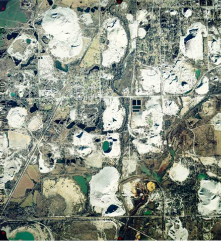
Figure 6-20. Aerial image of the area (1.5 miles × 1.5 miles) around the towns of Cardin and Picher in Oklahoma.
Source: Oklahoma Department of Environmental Quality
Introduction: Overview of Site and Mining History. Mining and milling in the Tri-state District began in the early 1900s and continued through the 1960s. Milling was originally completed on-site. Later, larger centralized mills were used ( McKnight and Fischer 1970 [CPRNF65S] McKnight, Edwin Thor, and Richard Philip Fischer. 1970. Geology and Ore Deposits of the Picher Field, Oklahoma and Kansas. Report 588. Professional Paper. USGS Publications Warehouse. https://doi.org/10.3133/pp588. ). The various mining and milling processes (blasting, crushing, tabling, jigging, and flotation) produced a coarse-grained “chat” waste that was conveyed into large piles (Figure 6-21) and a fine-tailings waste stream that was slurried into settling ponds.
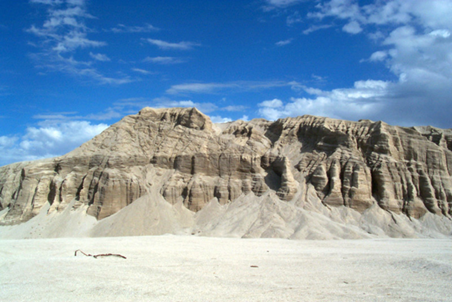
Figure 6-21. Kenoyer chat pile.
Source: Oklahoma Department of Environmental Quality
In Oklahoma, mills were located about every 40 acres due to leasing requirements of the Native American–owned lands. This practice resulted in many large chat piles and fine-tailings ponds covering an area of approximately 40 square miles. A few chat piles were several hundred feet high and covered more than 40 acres due to centralized milling ( Weidman 1932 [H6MYSV8L] Weidman, Samuel. 1932. The Miami-Picher Zinc-Lead District, Oklahoma. Vol. 56. University Press, University of Oklahoma and the Oklahoma Geological Survey. http://ogs.ou.edu/docs/bulletins/B56.pdf. ).
Regulatory Environment: Post-Mining Environmental Legacy. The Tar Creek Superfund Site (Figure 6-22) was included on the NPL in 1983, and the initial cleanup activities focused on surface water, groundwater, and mine water upwellings. In the early 1990s, the Indian Health Service in Ottawa County identified elevated blood lead concentrations in 35% of Native American children living in the area. This resulted in the formation of two other OUs focused on chat and fine-tailings accumulations in residential and nonresidential areas.
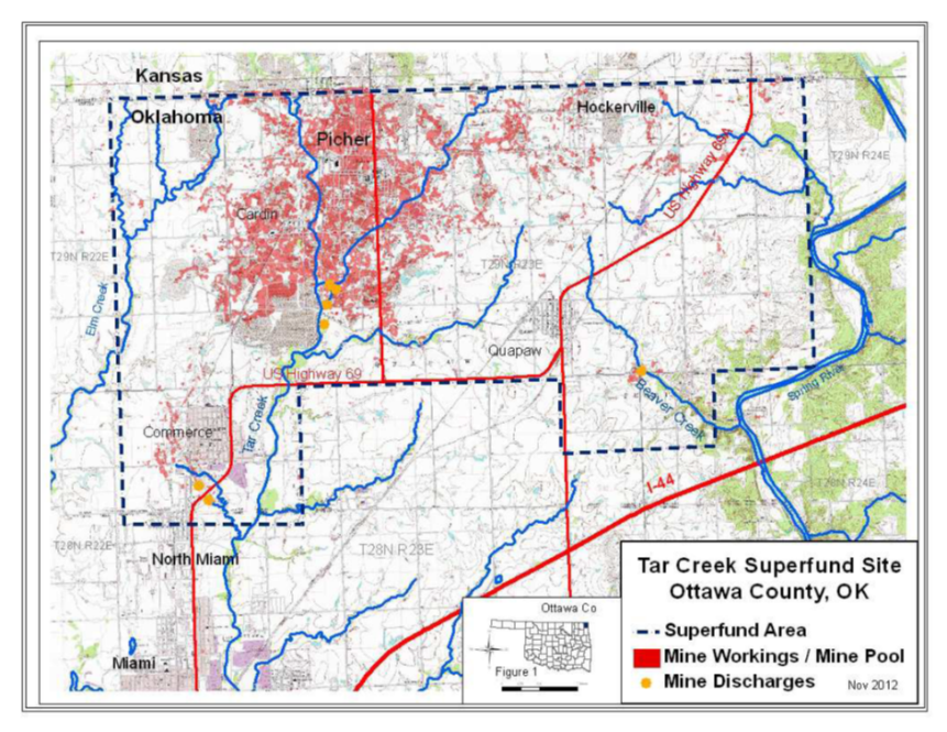
Figure 6-22. General location of the Tar Creek Superfund Site.
Source: Oklahoma Department of Environmental Quality
Much of the original chat volume, estimated at around 160 million cubic yards, is gone due to its use in construction projects over the course of more than a hundred years. An estimated 37.9 million cubic yards remained in 2008 ( AATA International, Inc. 2005 [YBPPX42Z] AATA International, Inc. 2005. “DRAFT: Work Plan Tar Creek OU4 RI/FS Program.” U.S. Environmental Protection Agency. https://semspub.epa.gov/work/06/182960.pdf. ). Reuse of bulk unencapsulated chat for gravel roads, fill in residential developments, and sand for children’s play areas has caused widespread environmental contamination from metals including cadmium, lead, and zinc contained therein. Affected media include soil, sediment, surface water, and groundwater, and more importantly, demonstratable human health impacts, primarily elevated blood lead levels ( USEPA 2008 [T6A5L5GE] USEPA. 2008. “Record of Decision. Operable Unit 4. Chat Piles, Other Mine and Mill Waste, Smelter Waste. Tar Creek Superfund Site. Ottawa County Oklahoma. OKD980629844.” U.S. Environmental Protection Agency. https://semspub.epa.gov/work/06/825746.pdf. ). These represent negative reuse applications. The impacts and proposed remediations have been fully documented in the RODs for Tar Creek OU2, Residential ( USEPA 1997 [XFB248IE] USEPA. 1997. “Record of Decision. Residential Areas Operable Unit 2. Tar Creek Superfund Site, Ottawa County, Oklahoma.” https://semspub.epa.gov/work/06/135318.pdf. ) and OU4, Non-residential ( USEPA 2008 [T6A5L5GE] USEPA. 2008. “Record of Decision. Operable Unit 4. Chat Piles, Other Mine and Mill Waste, Smelter Waste. Tar Creek Superfund Site. Ottawa County Oklahoma. OKD980629844.” U.S. Environmental Protection Agency. https://semspub.epa.gov/work/06/825746.pdf. ).
Remediation of Chat at the Tar Creek Site. The remedy selected for chat and fine tailings in the nonresidential areas (OU4) includes continued chat sales and marketing; backfilling/subaqueous disposal’ excavation of chat, fine tailings, and transition zone soils with transportation to an on-site repository; and consolidation/capping. The OU4 ROD estimated that 29,000,000 cubic yards of chat could be used for environmentally acceptable applications. The actual amount suitable for such uses may be 20% greater based on recent remedial actions ( CH2MHill 2021 [KVBP66I7] CH2MHill. 2021. Evaluation of Metals Recovery in Source Materials," Tar Creek Superfund Site Operable Unit 5 Remedial Investigation. ). Chat in the perimeter areas of the site is to be excavated and hauled to a nearby chat washing facility for future processing and use in asphalt, instead of being sent to a repository for disposal. Thus, private industry, chat owners, and local residents will profit from the sale of chat for environmentally safe reuse applications as defined in the “Chat Rule” (40 CFR Part 278) and the OU4 ROD. Reuse technology through chat sales is expected to continue for 30 years. If chat is sold, it must follow the certification and record-keeping requirements described in Section 19.2.2 of the ROD. Additionally, if chat is transported off site, the receiving facility must comply with the off-site rule for fugitive dust and stormwater runoff controls ( USEPA 2008 [T6A5L5GE] USEPA. 2008. “Record of Decision. Operable Unit 4. Chat Piles, Other Mine and Mill Waste, Smelter Waste. Tar Creek Superfund Site. Ottawa County Oklahoma. OKD980629844.” U.S. Environmental Protection Agency. https://semspub.epa.gov/work/06/825746.pdf. ).
Mining Waste Reuse
Currently, reuse applications for chat include aggregate in asphalt for construction and filling mine shafts as remediation. Remediation reuse also includes incorporation of excavated transition zone soils in the ET cap at the repository. In addition, reuse of chat and fine tailings has been identified for potential resource recovery of critical minerals, including REEs.
Characterization is one of the first steps in deciding whether a mining waste material has any beneficial reuses. Chat and fine tailings have been subjected to many geotechnical, chemical, and mineralogical tests and studies, albeit primarily for remediation purposes and to establish the concentrations of COCs – cadmium, lead, and zinc ( AATA International, Inc. 2005 [YBPPX42Z] AATA International, Inc. 2005. “DRAFT: Work Plan Tar Creek OU4 RI/FS Program.” U.S. Environmental Protection Agency. https://semspub.epa.gov/work/06/182960.pdf. ; Andrews et al. 2013 [KGJ2MFDH] Andrews, William J., Carlos J. Gavilan Moreno, and Robert W. Nairn. 2013. “Potential Recovery of Aluminum, Titanium, Lead, and Zinc from Tailings in the Abandoned Picher Mining District of Oklahoma.” Mineral Economics 26 (1): 61–69. https://doi.org/10.1007/s13563-013-0031-7. ; zotpress items=”{4889498:SIPSUNGE}” style=”chicago-author-date”]; CH2MHill 2021 [KVBP66I7] CH2MHill. 2021. Evaluation of Metals Recovery in Source Materials," Tar Creek Superfund Site Operable Unit 5 Remedial Investigation. ; Datin and Cates 2002 [MUL9CDTP] Datin, D. A., and David Cates. 2002. Sampling and Metal Analysis of Chat Piles in the Tar Creek Superfund Site, Ottawa County, Oklahoma. Oklahoma Department of Environmental Quality. ; Labar 2007 [MK9PVCM3] Labar, Julie. 2007. “Fate and Transport of Contaminants from Mining Waste Materials in Surface and Ground Water Environments.” School of Civil Engineering and Environmental Science, University of Oklahoma. ; Oklahoma DEQ 2000 [7KRFS3MI] Oklahoma DEQ. 2000. “Summary Report of Washed and Unwashed Mine Tailings (Chat) from the Tar Creek Superfund Site Area, Ottawa County, Oklahoma.” Oklahoma Department of Environmental Quality. ; White et al. 2022 [E94ZKGRP] White, Sarah Jane O., Nadine M. Piatak, Ryan J. McAleer, et al. 2022. “Germanium Redistribution during Weathering of Zn Mine Wastes: Implications for Environmental Mobility and Recovery of a Critical Mineral.” Applied Geochemistry 143. https://doi.org/10.1016/j.apgeochem.2022.105341. ).
The Remedial Investigation Feasibility Study for OU4 ( AATA International, Inc. 2005 [YBPPX42Z] AATA International, Inc. 2005. “DRAFT: Work Plan Tar Creek OU4 RI/FS Program.” U.S. Environmental Protection Agency. https://semspub.epa.gov/work/06/182960.pdf. ) is the most complete evaluation of bulk chat and fine tailings. The report focused on the COCs but also identified the concentrations of a target analyte list of 23 metals (Table 6-5).
Table 6-5. Summary of target analyte list metals concentrations in surface chat and surface fine tailings at the Tar Creek Site
| Chat | Fine Tailings | |||
| Metal | Range (mg/kg) |
Average (mg/kg) |
Range (mg/kg) |
Average (mg/kg) |
| Aluminum | 490 – 2,930 | 1,270 | 404 – 11,500 | 2,654 |
| Antimony | < 0.2 – 0.3* | 0.25 | 0.2 – 1.0 | 0.38 |
| Arsenic | < 3 – 9.5* | 4.61 | 4.9 – 26.4 | 9.08 |
| Barium | 3 – 13 | 6.5 | 3 – 39 | 15.69 |
| Beryllium | All <2 | – | < 0.2 – 2* | 0.57 |
| Cadmium | 40 – 133 | 74.57 | 32.2 – 170 | 72.44 |
| Calcium | 7,400 – 56,100 | 31,786 | 23,700 – 99,900 | 49,770 |
| Chromium | 8 – 30 | 8.29 | 5 – 50 | 16.9 |
| Cobalt | All <10 | – | < 1 – 10* | 2.75 |
| Copper | 30 – 90 | 53.2 | 35 – 680 | 158.3 |
| Iron | 2,690 – 10,900 | 5,949 | 5,440 – 22,700 | 8,749 |
| Lead | 355 – 1,730 | 829 | 510 – 19,200 | 7,302 |
| Magnesium | 3,500 – 20,600 | 11,200 | 7,530 – 14,700 | 11,604 |
| Manganese | 59 – 331 | 163 | 99.7 – 310 | 168.9 |
| Mercury | <0.05 – 0.19* | 0.11 | <0.05 – 0.83* | 0.24 |
| Nickel | < 10 – 12* | 8.86 | 6 – 50 | 16.4 |
| Potassium | <300 – 700* | 410 | 210 – 3,340 | 937 |
| Selenium | 0.8 – 16 | 4.2 | 0.8 – 19 | 5.63 |
| Silver | All <5 | – | < 1 – 10* | 2.95 |
| Sodium | All <300 | – | 60 – 560 | 116 |
| Thallium | 0.05 – 1.04 | 0.44 | 0.16 – 30.7 | 4.40 |
| Vanadium | <5 – 10* | 4.0 | 4.5 – 40 | 12.54 |
| Zinc | 8,990 – 29,900 | 17,514 | 2,920 – 28,800 | 12,599 |
Note: Chat: n = 14. Fine tailings: n = 12 for cadmium, lead, and zinc; n = 9 for other metals. All values are mg/kg dry weight.
* For those below the detection limit, half of the limit value was used in the calculation of the average.
In addition to cadmium, lead, and zinc in bulk chat, the only other metals with average concentrations greater than background values in site soils were arsenic, chromium, copper, magnesium, and selenium, while average concentrations of aluminum, barium, iron, manganese, and vanadium were lower in bulk chat than in site background soils ( AATA International, Inc. 2005 [YBPPX42Z] AATA International, Inc. 2005. “DRAFT: Work Plan Tar Creek OU4 RI/FS Program.” U.S. Environmental Protection Agency. https://semspub.epa.gov/work/06/182960.pdf. ).
Chat (Figure 6-23, also see Figure 3-1) is composed of a well-graded mixture of mainly chert with minor amounts of limestone and dolomite possessing angular particle sizes ranging from less than 0.075 mm to 9.51 mm with most of the mass in the coarser sizes. The metals concentrations and leaching potential vary within and among chat piles. Sieving prior to chemical tests shows metals concentrations in chat are inversely related to particle size, with the finer-sized material containing much higher (enriched or upgraded) concentrations (see Figure 4-2). Sieved (sized chat) samples subjected to grinding to less than 0.150 mm (ground-sized chat) showed no significant increase in metals concentrations compared to the pre-ground sample, further supporting the trend of higher metals concentrations in the finer-sized chat particles and not related to surface area. TCLP leach testing data indicates the larger-sized chat particles would be nonhazardous (<5 mg/L for lead) under RCRA Subtitle C. Test results for asphalt road millings indicated that chat encapsulated in asphalt had similar or lower concentrations compared to bulk chat. The amount of carbonate minerals in bulk chat is variable, and samples yield both net alkaline and net acidic ABA values. Thus, chat piles may produce circumneutral, acidic, or basic leachate.
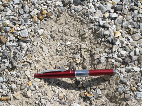
Figure 6-23. Chat showing surface armoring.
Source: Oklahoma Department of Environmental Quality
Life-Cycle Analysis of Chat. Because chat had been used inappropriately for many decades and those uses had caused severe environmental impacts due to the COCs contained therein, USEPA was concerned that unregulated chat sales would be a mechanism for continued spread of contamination. To incorporate chat sales into the ROD for OU4, a federal rulemaking process was implemented to justify chat reuse. USEPA conducted an LCA of chat use and developed the so called “Chat Rule,” which was finalized in the Federal Register on July 18, 2007 (Federal Register 72-137) as, “40 CFR Part 278—Criteria for the Management of Granular Mine Tailings (Chat) in Asphalt Concrete and Portland Cement Concrete in Transportation Construction Projects Funded in Whole or in Part by Federal Funds” ( U.S. Congress 2007 [XD2PBMCY] 40 CFR Part 278 — Criteria for the Management of Granular Mine Tailings (Chat) in Asphalt Concrete and Portland Cement Concrete in Transportation Construction Projects Funded in Whole or in Part by Federal Funds (2007). https://www.ecfr.gov/current/title-40/part-278. ). Chat from the Tri-state District may be reused safely in transportation projects if (a) it is used in hot, warm, or cold mix asphalt, in slurry seal, micro-surfacing, or in epoxy seal; or (b) it is used in Portland cement concrete, granular road base, flowable fill, stabilized road base, or chip seal, provided that, on a case-by-case basis, the material meets the standards of either an SPLP test for lead and cadmium drinking water maximum contaminant levels and acute water quality criteria for zinc or a site-specific risk assessment. Environmentally safe uses for non-transportation applications include cement and concrete used in (nonresidential) construction projects as described in the Chat Rule preamble and use in applications that encapsulate the chat as a material for manufacturing a safe product or as part of an industrial process (for example, glass, glass recycling), where all waste by-products are properly disposed of. In addition, the non-transportation cement and concrete material must pass one of the two evaluation criteria (SPLP or risk assessment). Other uses, including unencapsulated uses of chat, may be authorized only in state or federal remediation actions. The “Chat Rule” retains a certification requirement / notification such that states and the public know how and where chat is used in transportation projects.
Chat Use in Asphalt. Current law requires that transportation projects meet existing state DOT or Federal Highway Administration material specifications, which assure that the road surface, composed of hot, warm, or cold mix asphalt, concrete, or epoxy, is durable and will not degrade prematurely. In Oklahoma the specifications for asphalt concrete are contained in the Oklahoma DOT Standard Specifications for Highway Construction ( Oklahoma DOT 2019 [5LDB9GR8] Oklahoma DOT. 2019. “2019 Standard Specifications for Highway Construction.” https://www.odot.org/c_manuals/specbook/2019%20-FULL-SPEC-Web-Version.pdf. ). Note: some states have additional specification limits on metal concentrations in chat that must be met prior to its use in asphalt.
Today, outside of remediation purposes, most chat from the Tar Creek Superfund Site is being sold for reuse in environmentally safe ways as aggregate encapsulated in asphalt concrete. Chat properties that make it an ideal aggregate for asphalt include its hardness due to the large percentage of chert, its gradation, and the percentage of fractured faces due to it having been crushed during the milling process. Pile run chat (bulk chat) does not always meet Oklahoma DOT gradation specifications for base course (Type A) and surface course (Types B and C) designs; thus, mixing bulk chat with other non-chat aggregates may be necessary. Chat washing (wet screening) facilities (Figure 6-24) operate independently of the remedial action and process a large amount of chat for sale in which coarse chat particles are produced by dry or wet screening for blending with other non-chat aggregates to obtain proper gradation for reuse in asphalt. Consequently, only a fraction of a chat pile is reused. The fines from the chat washing operations are mostly deposited in settling ponds for later remediation by capping or potential reuse (i.e., resource recovery); alternatively, they may be slurried into the underground mine voids where such actions have been approved. A significant volume of sand- and silt-sized middling product of the wet screening process is generated that outpaces its demand for reuse in asphalt. Consequently, the chat at piles that have been completely reworked by washing operations (in other words, chat pile bases) contain much finer-sized poorly graded material than piles with original mill waste present, and this reduces the marketability of the chat as an aggregate for use in asphalt.
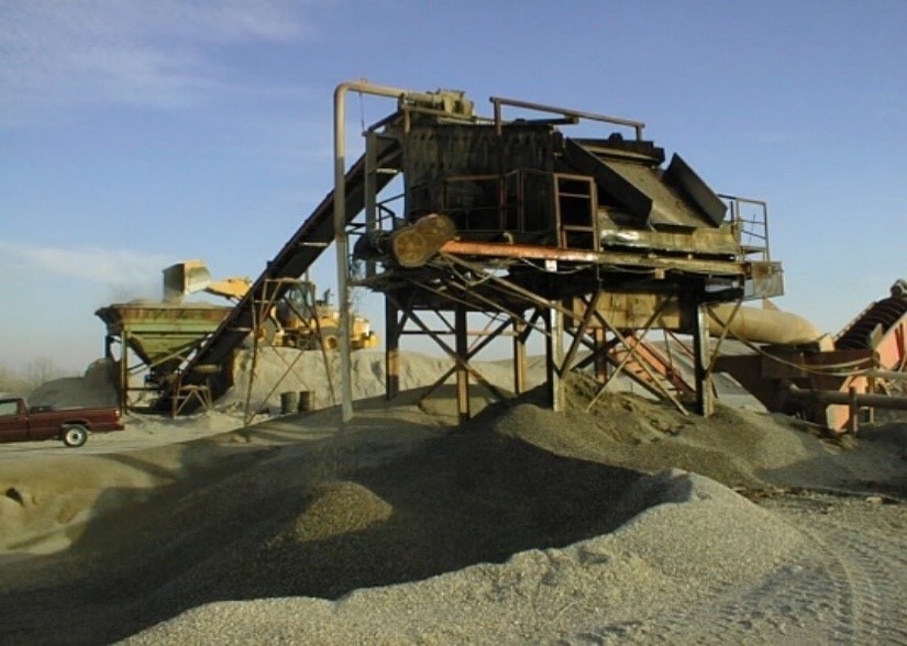
Figure 6-24. Chat washing.
Source: Oklahoma Department of Environmental Quality
The University of Oklahoma researchers conducted laboratory and field studies to determine the maximum use of pile run chat in asphalt paving ( Wasiuddin et al. 2008 [ILMA6I6Q] Wasiuddin, N., M. Zaman, Robert W. Nairn, S. Navaratnarajah, and R. Teredesai. 2008. Maximum Chat Utilization in Asphalt Paving at the Tar Creek Superfund Site — Test Road, School of Civil Engineering and Environmental Science. Oklahoma Department of Environmental Quality. ). The laboratory studies found that 80% and 50% bulk chat from a particular pile blended with non-chat limestone from a local source would meet Oklahoma DOT gradation specifications for Superpave surface course (S5 type) and base course (S3 type), respectively ( Wasiuddin et al. 2005 [Z5SP3P43] Wasiuddin, N., M. Zaman, and Robert W. Nairn. 2005. A Laboratory Study to Optimize the Use of Raw Chat in Hot Mix Asphalt for Pavement Application. ). Following the laboratory studies, a 3,100foot-long section of an unpaved county road was bid out and constructed with four different segments; each had different thicknesses of chat-asphalt surface and chat-asphalt base, and the subbase was chat stabilized with 10% Class C fly ash and 10% cement kiln dust. After 2.5 years of service, a distress survey of the “Test Road” was conducted. The test found that, although the road would not pass highway standards due to various issues including drainage (due to low permeability of the chat-stabilized bases) and rutting (due to air voids), it was much smoother than other asphalt roads in the county. Overall, the Test Road demonstrated that increased usage of pile run chat in asphalt that met Oklahoma DOT specifications could be accomplished.
Remediation Reuse: Remediation reuses include the following: (1) the use of bull rock / development rock and chat to fill the many mine shafts that are in various stages of collapse within remedial project areas and (2) use of transition zone soils as a component of the repository ET cap. Due to the limited volume of clean soil at the site and the large aerial extent of the repository, excavated transition soils (with low concentrations of COCs but exceeding cleanup levels) have been approved for use in the lower layers of the ET cap. These will be covered with clean topsoil to meet the ET cap specifications.
Potential Resource Recovery: Critical Minerals / Rare Earth Elements. The presence of several critical minerals has been documented in the mining waste at the site. Andrews ( Andrews et al. 2013 [KGJ2MFDH] Andrews, William J., Carlos J. Gavilan Moreno, and Robert W. Nairn. 2013. “Potential Recovery of Aluminum, Titanium, Lead, and Zinc from Tailings in the Abandoned Picher Mining District of Oklahoma.” Mineral Economics 26 (1): 61–69. https://doi.org/10.1007/s13563-013-0031-7. ) identified zinc, aluminum, lead, and titanium as possessing potential economic recovery value based on their larger concentrations in the fine-sized material and spot price at the time. Some metals with high market prices and lower concentrations were present, such as gallium (14.35 mg/kg), germanium (8.5 mg/kg), cesium (7.7 mg/kg), and rubidium (38.7 mg/kg). These could add significant value to a metal recovery operation with price per metric ton of mining waste fines of $20.84, $36.37, $135.52, and $496.54, respectively ( USGS 2024 [2W482Y5Q] USGS. 2024. “Mineral Commodity Summaries 2024: U.S. Geological Survey.” https://doi.org/10.3133/mcs2024. ).
At the direction of USEPA Region VI, CH2MHill ( CH2MHill 2021 [KVBP66I7] CH2MHill. 2021. Evaluation of Metals Recovery in Source Materials," Tar Creek Superfund Site Operable Unit 5 Remedial Investigation. ) investigated the economic potential recovery of zinc in the different-sized fractions of chat and fine tailings. They identified zinc in the form of sphalerite (ZnS) concentrated at an average weight percent of 2.6% in the fine-sized material due to “upgrading” as containing potential economic value based on the total mass of zinc and metal prices at that time ($1.07 per pound). Assuming 100% zinc recovery from the estimated 8 million cubic yards of fine-sized material less than 75 µm (in other words, passing the No. 200 sieve), 420 million pounds of zinc worth $440 million is available for recovery. The report provided recommendations for further studies to fully evaluate the economic viability of zinc recovery.
White et al. ( White et al. 2022 [E94ZKGRP] White, Sarah Jane O., Nadine M. Piatak, Ryan J. McAleer, et al. 2022. “Germanium Redistribution during Weathering of Zn Mine Wastes: Implications for Environmental Mobility and Recovery of a Critical Mineral.” Applied Geochemistry 143. https://doi.org/10.1016/j.apgeochem.2022.105341. ) evaluated fine-sized particles from chat piles with microanalytical techniques, total metals analyses, and SPLPs, as well as geochemical modeling, to determine the distribution and mineral hosts of germanium. The report indicated germanium is typically associated with zinc sulfide (sphalerite – ZnS) and is recovered as a by-product of zinc smelting. Germanium concentration was found in bulk chat at just 4 to 5 mg/kg and found to be enriched in the finer-sized fractions (<37 µm) at 12 ± 3 mg/kg. They also found that 64% of the germanium (320 mg/kg) was distributed in hemimorphite (Zn4Si2O7(OH)2H2O), which represents 1.4 percentage by weight (wt. %) of chat; 26% was in quartz (90 wt. % of chat); and only 10% was in sphalerite (0.3 wt. % of chat). This indicates germanium has been redistributed from sphalerite to the fine-grained weathering product hemimorphite, which impacts the potential recovery of germanium as well as its mobility and bioavailability.
Another potential source of critical minerals and REEs is in the solids of the main process units (oxidation ponds and vertical flow bioreactors) of the several passive treatment systems currently treating mine water discharges at Commerce, Oklahoma. McCann and Nairn ( McCann and Nairn 2022 [26RZQRIS] McCann, Justine I., and Robert W. Nairn. 2022. “Characterization of Residual Solids from Mine Water Passive Treatment Oxidation Ponds at the Tar Creek Superfund Site, Oklahoma, USA: Potential for Reuse or Disposal.” Cleaner Waste Systems 3. https://doi.org/10.1016/j.clwas.2022.100031. ) evaluated the accumulated solids in the oxidation ponds, the first units of the Mayor Ranch and SE Commerce treatment systems to determine the metals content and potential reuse opportunities for the accumulated iron-rich sludge there. The TCLP limits for lead and cadmium indicated the sludge to be nonhazardous, but a few groundwater quality criteria were exceeded in the SPLP results; this limited the beneficial reuse options and pointed to the need for additional studies to fully evaluate options like reuse as soil amendments. Due to the high iron (oxyhydr)oxide concentrations, a potential reuse option for the passive treatment system oxidation pond residuals is as paint pigments. Aluminum and nickel at concentrations in the hundreds of mg/kg indicate a potential for resource recovery.
Summary and Future Data Needs: Reuse of Tar Creek chat as an aggregate in asphalt will continue well into the future, but there is a need for studies to identify additional uses for this material. For example, chat in the minus 35 to plus 80 mesh fraction was evaluated for use as a proppant in the oil and gas industry but failed to meet key criteria including lack of roundness (sphericity) and crush resistance strength. Clearly, economic recovery of critical minerals is possible, with approximately 14 million cubic yards of fine-sized material less than the 100-mesh sieve size (<150 µm). Further investigations using microanalytical techniques and geochemical modeling to determine concentrations, distributions, and speciation of critical minerals and REEs within the fine-sized mining waste is needed, as well as procedures for the processing of such materials for extraction and recovery. An economic evaluation and LCA on the feasibility of economic recovery of critical minerals and REEs from the Tar Creek mining waste is needed for comparison to the costs of remediation of the mining waste and potential offset of remediation costs. Existing chat washing operations that produce aggregate from the chat piles for use in asphalt may need to be modified to collect the fine-sized (<150 µm) fraction of mining waste for future metals recovery.
6.2.8 South Carolina – Brewer Gold Mine Superfund Site, Abandoned Mine Land Regulatory Reuse
Value Proposition Statement. The following case study describes the legal process to market an abandoned superfund mine for reuse that will align with USEPA’s remediation goals.
Introduction. The Brewer Site produced 178,000 ounces of oxide gold from two open pits that extended to depths of 50-meters. Brewer Gold Company (Brewer), which is owned and operated by the United Kingdom, processed more than 12 million tons of ore and waste rock mined from two open pits. After ceasing mining operations, Brewer began reclamation efforts in 1995 and continued into 1999, overseen by SCDHEC. Brewer fell short of achieving a fully reclaimed site. Brewer abandoned the site in 1999, leaving SCDHEC and the USEPA to manage the site, finalize reclamation, and treat AMD in perpetuity. SCDHEC and USEPA worked together to find an innovative solution to the $1.2 million per year (and increasing) issue in perpetuity.
Site Background
Geology. The Brewer Gold Mine occurs within the Carolina Slate Belt, a northeast-trending zone of metamorphic rocks that extends from northern Georgia to southern Virginia. The eastern limit of exposed Slate Belt rocks occurs about 1 mile east of Brewer and is defined by the onlap of Cretaceous-age and younger sediments of the Coastal Plain Province that cover the Slate Belt strata. Rocks in the area of the Brewer mine consist of deformed and regionally metamorphosed rhyolite, andesite volcanic tuffs, breccias, and flows of late Precambrian to Cambrian age that are overlain by metamorphosed sedimentary strata that include volcanic mudstones, siltstones, and sandstones (Figure 6-25). In the Brewer mine area, the regional metamorphic grade of the metavolcanic rocks has been overprinted with concentric zones of hydrothermal alteration associated with the gold mineralization. Gold was present within pyrite and copper sulfide grains and as free particles ( Pardee and Park 1948 [XURV6IJV] Pardee, J. T., and C. F. Park Jr. 1948. Gold Deposits of the Southern Piedmont. Report 213. Professional Paper. USGS Publications Warehouse. https://doi.org/10.3133/pp213. ; Sheetz 1991 [SP222385] Sheetz, J. W. 1991. “The Geology and Alteration of the Brewer Gold Mine in South Carolina.” ). Other metallic minerals present in the ore in minor quantities included enargite (copper arsenosulfide), covellite (copper sulfide), chalcopyrite (copper iron sulfide), tennantite-tetrahedrite (copper arsenic-antimony sulfide), sphalerite (zinc sulfide), galena (lead sulfide), cassiterite (tin oxide), bismite (bismuth oxide), native bismuth, and a variety of iron oxides and hydroxides ( Graton and Lindgren 1906 [S8IACU2H] Graton, L. C., and Waldemar Lindgren. 1906. “Reconnaissance of Some Gold and Tin Deposits of the Southern Appalachians: With Notes on the Dahlonega Mines.” https://digital.library.unt.edu/ark:/67531/metadc861740/. ; Pardee and Park 1948 [XURV6IJV] Pardee, J. T., and C. F. Park Jr. 1948. Gold Deposits of the Southern Piedmont. Report 213. Professional Paper. USGS Publications Warehouse. https://doi.org/10.3133/pp213. ; Sheetz 1991 [SP222385] Sheetz, J. W. 1991. “The Geology and Alteration of the Brewer Gold Mine in South Carolina.” ).
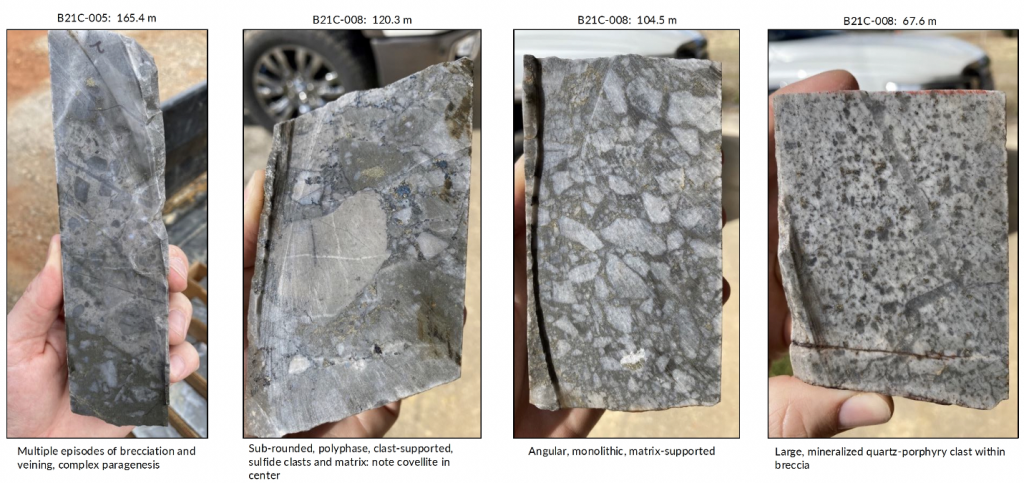
Figure 6-25. Core drilled from the Brewer Site demonstrating differences in alteration.
Source: Jen Spohn, Carolina Rush Corporation
Site History. The 1,000-acre Brewer Gold Mine Site is located on the western border of Chesterfield County, in a rural area approximately 1 mile due west of Jefferson, South Carolina, in Chesterfield County. The disturbed area that supported most mining activities covers 230 acres in the eastern portion of the larger property. The site features are summarized in Figure 6-26.
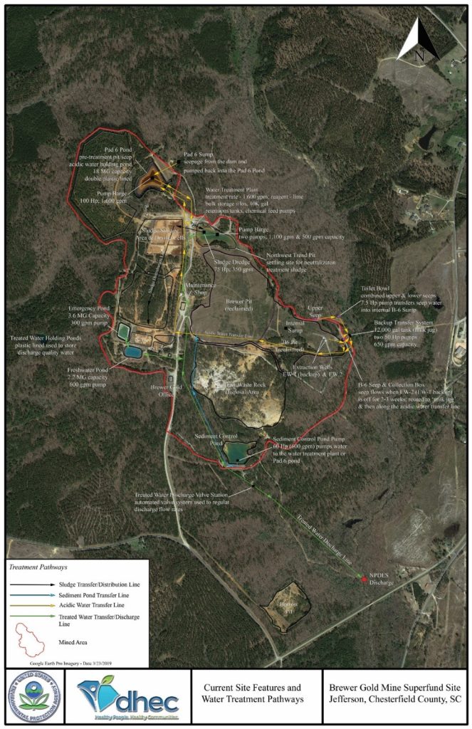
Figure 6-26. Current site operations and conditions at the Brewer Gold Mine.
Source: USEPA (2021b)
The Brewer Gold Mine was intermittently mined for gold from the 1820s through the 1990s. The most recent mining began in 1987 when Brewer used a cyanide heap leach method to produce gold up until approximately 1995. Although the pits extended below the water table, Brewer operated pumps to keep them dry for mining.
In 1990, following large rainstorms, a dam broke and allowed more than 10 million gallons of cyanide/gold solution to escape and flow into Little Fork Creek. Fish were killed in the creek and in Lynches River for nearly 50 miles downstream. USEPA and SCDHEC responded to the emergency. The dam and plastic-lined pond were repaired, and the company resumed mining in 1991.
At the end of operations in 1995, Brewer closed and reclaimed the mine following a plan outlined under an order issued by the SCDHEC. As described in the reclamation plan, a limestone-filled subdrain was keyed into the bedrock and extended eastward across waste rock fill in the B-6 Pit and westward into the Brewer Pit. The purpose of this subdrain was to raise the pH of groundwater as it traveled out of the Brewer Pit. As closure activities were completed, highly contaminated groundwater began to flow from a seep on the hillside between the backfilled pits and Little Fork Creek, 10 feet below the limestone subdrain. Due to a lower than anticipated water level within the pits, the subdrain never functioned as a passive treatment system as intended. The plan to demolish the temporary wastewater treatment plant during closure was abandoned when the plant was needed to treat the contaminated seepage ( USEPA 2021 [HT359D5V] USEPA. 2021. “Third Five-Year Review Report for Brewer Gold Mine Superfund Site. Operable Unit 1. Chesterfield County, South Carolina.” U.S. Environmental Protection Agency. https://semspub.epa.gov/work/04/11173674.pdf. ).
In 1999, following completion of the closure activities and failure of the passive treatment system, Costain Holdings (the parent company of Brewer) abandoned the site. In response to the owner’s abandonment of the Brewer Gold Mine Site, SCDHEC requested emergency assistance from USEPA Region 4 to address the threat to water quality posed to Little Fork Creek by the site. USEPA initiated an emergency response on December 2, 1999, and authorized actions to continue operating the seepage collection and treatment system. As part of the USEPA removal action, an extraction well was installed in the B-6 Pit to pump contaminated water from the pit to a storage pond from which it can be taken for treatment and discharged. By USEPA’s estimates, failure to continue treatment of the contaminated waters would result in upward of 125 million gallons of untreated groundwater and runoff flowing from the site into Little Fork Creek annually, which would severely degrade the water quality of the creek.
On April 27, 2005, USEPA placed the site on the NPL. As part of the Interim Remedial Action, USEPA and SCDHEC have continued to operate the temporary wastewater treatment plant that was constructed by Costain Holdings in 1995.
Regulatory Issues. The final OU1 Surface Water Protection ROD, signed in 2014, selected the construction of a new 56 million-gallon treatment plant with passive selenium reduction and source control of sediment pond water to treat impacted water and construction of a rapid dewatering system–Joshua system to treat the sludge. The combined present worth cost (including both capital and operations and maintenance costs) as described in the final remedial design for the combined water and sludge remedies is estimated at approximately $21.25 million. The annual operation and maintenance cost was estimated to be $1.15 million.
Table 6-6 shows the operations and maintenance costs for the currently operating interim remedy. Without the current 90/10 cost-share component from USEPA, the state’s Hazardous Waste Contingency Fund would be completely bankrupted by this site alone in five years. USEPA elected to continue to implement the Interim ROD while SCDHEC pursued putting the property into a receivership to allow time for exploration activity by a potential purchaser before implementing the final ROD.
Table 6-6. Brewer Gold Mine operations and maintenance costs 2016—2023 (interim remedy for OU1)
| Calendar Year | Annual Costs |
| 2016 | $1,167,000 |
| 2017 | $1,185,000 |
| 2018 | $1,212,000 |
| 2019 | $1,171,000 |
| 2020 | $1,358,000 |
| 2021 | $1,314,000 |
| 2022 | $1,182,000 |
| 2023 | $1,361,000 |
Mining Waste Reuse Strategy
Receivership Process. Mining companies approached USEPA about the possibility of exploring the superfund site for additional resources; their interest was based on the site’s geological and mining history and on the presence of gold mines in the surrounding area. Unfortunately, the site was not owned by SCDHEC or USEPA, and therefore there was no mechanism to allow for exploration. SCDHEC and USEPA have an interest in recovering past and future costs spent on the investigation and ongoing cleanup of the superfund site. Therefore, SCDHEC filed a motion for the appointment of a receiver to manage third-party access to the property and facilitate potential leasing, sale, or other use or disposition of the property, including the potential renewal of mining exploration and development.
Allowing a receiver to market the property serves to facilitate reimbursement of SCDHEC’s and USEPA’s response costs, reduction of financial and operational burdens on the state and USEPA, implementation of more cost-effective and permanent means of carrying out remedial action at the site, and facilitate potential beneficial reuse of the property.
Legal Timeline. Table 6-7 lists the documentation submitted for the receivership to be established. Brewer provided notification that it intended to close the mine in 1995. Following this notification, SCDHEC issued an Administrative Order on Consent, which required Brewer to submit a design for closure and reclamation of the site. As explained above, due to unexpectedly low water levels in the mine pits, the passive treatment system did not function as intended.
Table 6-7. Timeline used to appoint a receiver to allow exploration
| Date | Document |
| 2006 | Superfund state contract |
| 2014 | First amendment superfund state contract |
| February 1, 2019 | Summons and complaint filed in state court |
| February 4, 2019 | Filed a motion for appointment of a receiver, which included the following: Affidavit from the Division Director describing the environmental issues at the site Affidavit from the potential receiver regarding their qualifications 2014 USEPA ROD Brewer Gold Company business entity status USEPA concurrence for SCDHEC to seek a receiver Second five-year review report |
| February 4, 2019 | Order for the appointment of a receiver included the following: Agreement for temporary receiver Certificate of Service stating motion for appointment of a receiver was sent to all parties |
| February 8, 2019 | Signed executed agreement for temporary receiver |
| February 8, 2019 | Failure to serve complaint on Brewer due to the company’s dissolved state |
| March 12, 2019 | Motion for service publication and attorney affidavit |
| March 13, 2019 | Order authorizing service by publication |
| Late 2019 to early 2020 | Mining company presentations (technical and financial) |
| March 2020 | First Brewer lease agreement with option to purchase |
| July 2022 | Escrow agreement for fourth amendment to the lease |
| Ongoing | Receiver progress reports to the court |
On November 9, 1999, Brewer notified SCDHEC of its intent to terminate corporate operations effective November 30, 1999, and exit the property at that time. SCDHEC filed suit to enjoin Brewer from ceasing operation and maintenance of the temporary wastewater treatment system and to require Brewer to ensure continued operation and maintenance of the site in compliance with applicable environmental laws until reclamation and closure were complete.
Following a hearing on November 29, 1999, the court issued an injunction pending final disposition of the merits of the case requiring Brewer to continue proper operation and maintenance of the temporary water treatment system; however, Brewer proceeded with the shutdown of all operations and abandoned the property. Brewer has not had any presence at the property and has taken no responsibility for continuing operations, maintenance, and remediation at the site since November 1999. Brewer’s corporate existence was void in its state of incorporation, Delaware, on March 1, 2001, and Brewer’s corporate existence ceased in South Carolina on December 31, 2007.
In February 2019, in pursuit of a receivership, SCDHEC filed a summons and complaint, which required Brewer to file an answer within 30 days. Due to the company’s dissolved status, the complaint could not be served. Subsequently, the receiver was promptly appointed by the court and began looking for potential purchasers.
By October 2019, two mining companies had presented their technical interpretations of the Brewer Mine and their proposals for exploration to the receiver. Only one company can explore the site at a time. Subsequently, the receiver brought in SCDHEC and USEPA to discuss which proposal provided a greater overall benefit. By March 2020, a mining company had been selected, and the receiver and company had signed a mining lease with an option to purchase. The factors considered by the receiver, SCDHEC, and USEPA when making their selection are listed below.
- What resource is each company searching for? What are the economics associated with that resource?
- What is the company’s background? How have they handled their other mining sites?
- What is the scope of the resource recovery? How much does the company need to prove exists before they decide to buy the site?
- What time frame is the company considering? How fast can they determine whether they want the site or not?
- How much will they pay to acquire the site? How much of that money goes to the state vs. USEPA?
- When would the company take over the operation and maintenance costs? Before buying the site? As soon as they buy the site?
- What is the mining company’s preference on whether the site remains on the NPL or not?
- How much liability for past operations will the company be willing to take on?
- How much of the past costs is the company willing to pay to the state and USEPA?
- What experience do these companies have regarding a superfund/heavily regulated site?
As part of the lease agreement, the selected mining company agreed to provide the receiver with all results of their operations, including data related to or derived from drilling, testing, evaluation, and other analysis of minerals and all other data related to the company’s operations. This allows the receiver to provide exploration data to another company if the lease and exploration fall through with the first company. In this event, the receiver is allowed to share the data but not the geological and technical interpretations of that data. The interpretations remain the intellectual property of the original mining company. This allows SCDHEC to entice another company to buy the site if the original exploration company chooses not to buy the site. With this stipulation, a new mining company and SCDHEC do not start at the beginning again.
Reuse Application/Current Status. As of 2024, mining exploration under the fifth lease amendment with an option to purchase is ongoing. To date, the mining company has completed two phases of drilling that included 5,400 meters of core drilling, 350 meters of sonic hole drilling, 194 meters of rotary air blast drilling (to a maximum depth of 24 meters), 2D-IP geophysics, and induced polarization survey. The company is currently working on the a third drilling program ( Rush 2023 [PIB9X3G7] Rush, Carolina. 2023. “Brewer Gold and Copper Project.” Brewer Gold and Copper Project. https://thecarolinarush.com/brewer-gold-copper-project/. ).